


Click Image to Enlarge
Tennessee Counties
There are ninety-five counties in the State of Tennessee. The oldest county is Washington County, founded in 1777. The most recently formed county is Chester County (1879)Carter County, Tennessee
Carter County Education, Geography, and History
Carter County is a county located in the state of Tennessee. Based on the 2010 census, the population was 57,424. Its county seat is
Elizabethton. The county is named in honor of Landon Carter, an early settler active in the State of Franklin movement.
Carter County is part of the Johnson City, TN Metropolitan Statistical Area, which is a component of the Johnson City–Kingsport–Bristol, TN-VA
Combined Statistical Area, commonly known as the "Tri-Cities" region of Northeast Tennessee.
Etymology - Origin of Carter County Name
Named in honor of Landon Carter (1760-1800), treasurer of Washington and Hamilton districts of North Carolina, speaker of the State of Franklin senate and its secretary of state, militia officer.
Demographics:
County QuickFacts: CensusBureau Quick Facts
History of Carter County
The area was originally claimed by Britain as part of the Clarendon settlements of the Province of Carolina, although actually populated at
the time by the Cherokee.
The area was part of (though seldom actually administered by) the following jurisdictions in its early history:
New Hanover Precinct (1729-1734)
Bladen County (1734-1749)
Anson County (1749-1753)
Rowan County (1753-1775)
Created 1796 from Washington County; named in honor of Landon Carter (1760-1800), treasurer of Washington and Hamilton districts of North Carolina, speaker of the State of Franklin senate and its secretary of state, militia officer.
Carter County was formed in 1796 from Washington County. (Acts of Tennessee 1796 [March Session], Chapter 31).
J. G. M. Ramsey records within his 1853 Annals of Tennessee that the State of Franklin established Wayne County from sections of both
Washington County and a part of Wilkes County "lying west of the extreme heights of the Apalachian or Alleghany Mountains, into a separate and
distinct county by the name of Wayne... This new county covered the same territory now embraced in the limits of Carter and Johnson counties."
The county seat, Elizabethton, is named for Carter's wife, Elizabeth MacLin Carter.
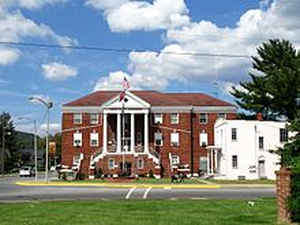
There was a fire at the Carter County courthouse in 1933.
Tennessee Encyclopedia of History and Culture
Carter County is located in the northeast corner of Tennessee. It was created from Washington County in 1796 and
named in honor of Landon Carter, treasurer of the Washington and Hamilton Districts of North Carolina and the State
of Franklin's Speaker of the Senate and Secretary of State. Carter County's 348 square miles blend mountains, the
Watauga and Doe Rivers, and beautiful valleys into an inspiring Appalachian landscape. The Appalachian Trail passes
through the county and most of eastern Carter County is within the Cherokee National Forest. Roan Mountain State
Park, at the county's border with North Carolina, is one of the most beloved scenic spots in the state. The county's
population in 2000 was 56,742.
Carter County is extremely significant in Tennessee's settlement history. Permanent settlers arrived along the
Watauga River in the late 1760s; William Bean was one of the earliest, and his farm was eight miles west of the
Sycamore Shoals of the Watauga River. James Robertson established a river valley farm in 1770 and stayed there until
moving to the Cumberland River in 1779. Valentine Sevier Sr., the father of John Sevier, lived near Sycamore Shoals.
Also in the early 1770s John Carter established his plantation just north of present-day Elizabethton. This notable
Revolutionary War patriot was the father of Landon Carter, for whom the county is named. In 1772 the settlers along
the Watauga River established the Watauga Association, and three years later, in 1775, land speculator Richard
Henderson and Cherokee leaders met at Sycamore Shoals to negotiate the Transylvania Purchase. During the American
Revolution Fort Watauga provided refuge from attacks by Old Abram and other Cherokee warriors. In 1780 approximately
eleven hundred Overmountain Men gathered at Sycamore Shoals before marching to Kings Mountain. The Sycamore Shoals
State Historic Area preserves key historical places, including the Overmountain Men muster ground, the Shoals, the
reconstructed Fort Watauga, and the John and Landon Carter Mansion. Find more from the Tennessee Encyclopedia of History and Culture:
CARTER COUNTY
Geography: Land and Water
As reported by the Census Bureau, the county has a total area of 348 square miles (900 km2), of which, 341
square miles (883 km2) of it is land and 7 square miles (17 km2) of it (1.89%) is water.
Neighboring Counties
Bordering counties are as follows:
- Sullivan County (north)
- Johnson County (northeast)
- Avery County, North Carolina (southeast)
- Mitchell County, North Carolina (south)
- Unicoi County (southwest)
- Washington County (west)
Education
Colleges
Northeast State Community College and the Tennessee Colleges of Applied Technology have satellite campuses in Elizabethton.
Milligan College's main campus and Emmanuel Christian Seminary are located in the community of Milligan College, part of Elizabethton.


Click Image to Enlarge
