


Click Image to Enlarge
Tennessee Counties
There are ninety-five counties in the State of Tennessee. The oldest county is Washington County, founded in 1777. The most recently formed county is Chester County (1879)Greene County, Tennessee
Greene County Education, Geography, and History
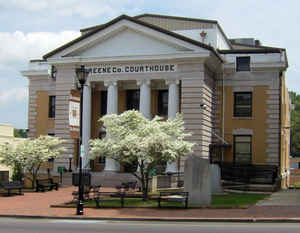
Greene County is a county located on the eastern border of the state of Tennessee. Based on the 2010 census, the population was 68,831. Its
county seat is Greeneville, and the current county mayor is David Loy Crum (R).
Greene County comprises the Greeneville, TN Micropolitan Statistical Area.
Etymology - Origin of Greene County Name
Named in honor of Nathanael Greene (1742-1786), Revolutionary War commander at Trenton who succeeded Horatio Gates in command of the Army of the South and forced the British out of Georgia and the Carolinas.
Demographics:
County QuickFacts: CensusBureau Quick Facts
History of Greene County
Created 1783 from Washington County; named in honor of Nathanael Greene (1742-1786), Revolutionary War commander at Trenton who succeeded Horatio Gates in command of the Army of the South and forced the British out of Georgia and the Carolinas.
Greene County was formed in 1783 from Washington County
(Acts of North Carolina 1783, Chapter 51).
Tennessee Encyclopedia of History and Culture
Greene County lies in the Great Valley of Tennessee in the northeast corner of the state. Its valleys are
enriched by the disintegrated limestone that lies below them. Bays Mountain, one of the three sets of high ridges
that run through the valley, is located on the north side of the county and is drained by Lick Creek. The Unaka, or
Great Smoky, Mountains to the east slope down to the Nolichucky River. The resources of Greene County, including the
creeks and rivers, plentiful game, and good bottomlands, attracted generations of Native Americans. Places like the
Camp Creek site, along the banks of the Nolichucky River, document Native American activities during the Woodland
Period.
Settlement began about 1772 when Jacob Brown and a couple of families from North Carolina moved to a camp on the
banks of the Nolichucky, the first in its valley. In 1775 Brown leased from the Cherokees a large tract of land
which was titled to him as part of the Washington District of North Carolina. In 1777 Henry Earnest, a Swiss
immigrant, established Elmwood Farm along the Nolichucky River. It is the oldest Tennessee Century Farm. A great
influx of settlers between 1778 and 1783 made residents of the area anxious for separate government, which was
achieved through the efforts of Daniel Kennedy and Waightstill Avery. Greene County, part of North Carolina, was
established in 1783 and named in honor of General Nathanael Greene of Rhode Island, under whom many settlers had
fought during the Revolutionary War. Greene County participated in the State of Franklin movement along with fellow
upper East Tennessee counties Sullivan and Washington. The split that precipitated the end of the State of Franklin
occurred during the 1785 constitutional convention held at Greeneville. Find more from the Tennessee Encyclopedia of History and Culture:
GREENE COUNTY
Geography: Land and Water
As reported by the Census Bureau, the county has a total area of 624 square miles (1,616 km2), of which, 622 square miles (1,610 km2) of it is land and 2 square miles (6 km2) of it is water. The total area is 0.39% water.
Most of Greene County is located within the Ridge-and-Valley Appalachians, a range characterized by long, narrow ridges alternating with
similarly-shaped valleys. Bays Mountain, a prominent ridge in this range, forms much of Greene's northern border with Hawkins County. The
extreme southeastern part of Greene County is located within the Blue Ridge Mountains, specifically a subrange of the Blue Ridge known as the
Bald Mountains. This range straddles Greene's border with North Carolina, and includes the county's two highest points: Gravel Knob, which
rises to over 4,840 feet (1,480 m), and 4,844-foot (1,476 m) Camp Creek Bald (it's uncertain which is higher due to lack of an exact
measurement for Gravel Knob's elevation).
Greene County is drained by the Nolichucky River, which traverses the southern half of the county. This river is impounded by Nolichucky Dam
south of Greeneville, creating Davy Crockett Lake.
Neighboring Counties
Bordering counties are as follows:
- Hawkins County (north)
- Washington County (east)
- Unicoi County (southeast)
- Madison County, North Carolina (south)
- Cocke County (southwest)
- Hamblen County (west)
Education


Click Image to Enlarge
