


Click Image to Enlarge
Tennessee Counties
There are ninety-five counties in the State of Tennessee. The oldest county is Washington County, founded in 1777. The most recently formed county is Chester County (1879)Lewis County, Tennessee
Lewis County Education, Geography, and History
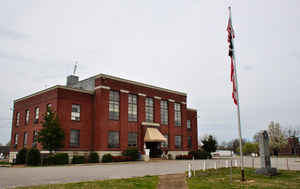
Lewis County is a county located in the state of Tennessee. Based on the 2010 census, the population was 12,161. Its county seat is Hohenwald. The county is named for explorer Meriwether Lewis, who died and was buried at Grinder's Stand near Hohenwald in 1809.
Etymology - Origin of Lewis County Name
Named in honor of Meriwether Lewis (1774-1809), appointee of President Jefferson to explore the Louisiana Purchase in 1804 who died violently on the Natchez Trace.
Demographics:
County QuickFacts: CensusBureau Quick Facts
History of Lewis County
Created 1843 from Hickman, Lawrence, Maury and Wayne counties; named in honor of Meriwether Lewis (1774-1809), appointee of President Jefferson to explore the Louisiana Purchase in 1804 who died violently on the Natchez Trace.
Lewis County was formed in 1843 from Hickman, Lawrence, Maury and Wayne counties. (Acts of Tennessee 1843, Chapter 38).
Tennessee Encyclopedia of History and Culture
Lewis County was established in 1843 from parts of Perry, Hickman, Maury, Lawrence, and Wayne Counties and named
in honor of Meriwether Lewis, the famed explorer of the Lewis and Clark expedition, who died within the county's
boundaries. The first courts were held in the home of John Blackburn on Swan Creek. The first county seat was
located there in 1846 and named Gordon in honor of Powhattan Gordon of nearby Columbia. Two years later the county
seat moved to Newburg, a fifty-acre tract donated by Hugh B. Venable and Robert O. Smith, which stood on the
dividing ridge between Big and Little Swan Creeks. Demands for a more central location for the county seat, coupled
with the economic decline of Newburg, led officials to move the seat of government to Hohenwald in 1897; the town
received its charter in 1923.
Located on the western Highland Rim, Lewis County's thin and flinty soil has not been conducive to agriculture.
Corn, wheat, oats, grasses, and especially peanuts constituted the principal crops. The wealth of the county
consisted of iron ore deposits, primarily in the southern part of the county. In 1834 Napier and Catron erected
Napier Furnace, which produced approximately ten tons of pig iron per day and employed twenty-five laborers. By 1880
it had ceased operations. The Rockdale Cotton Factory opened in 1825. Producing cotton yarn and employing mostly
female workers, the factory operated until late in the Civil War. Other antebellum manufacturing included sawmills,
gristmills, and barrel making. Find more from the Tennessee Encyclopedia of History and Culture:
LEWIS COUNTY
Geography: Land and Water
As reported by the Census Bureau, the county has a total area of 282 square miles (732 km2), of which, 282
square miles (731 km2) of it is land and 0 square miles (1 km2) of it (0.13%) is water.
Neighboring Counties
Bordering counties are as follows:
- Hickman County (north)
- Maury County (east)
- Lawrence County (south)
- Wayne County (southwest)
- Perry County (west)
Education


Click Image to Enlarge
