


Click Image to Enlarge
Tennessee Counties
There are ninety-five counties in the State of Tennessee. The oldest county is Washington County, founded in 1777. The most recently formed county is Chester County (1879)Loudon County, Tennessee
Loudon County Education, Geography, and History
Loudon County is a county located in the state of Tennessee. Based on the 2010 census, the population was 48,556. Its county seat is Loudon.
Loudon County is included in the Knoxville, TN Metropolitan Statistical Area.
Etymology - Origin of Loudon County Name
Named for Fort Loudoun, erected 1756 by the British and named in honor of the Earl of Loudoun, commander-in-chief of British and American forces in the French and Indian War.
Demographics:
County QuickFacts: CensusBureau Quick Facts
History of Loudon County
Created 1870 from Roane, Monroe, Blount and McMinn counties; named for Fort Loudoun, erected 1756 by the British and named in honor of the Earl of Loudoun, commander-in-chief of British and American forces in the French and Indian War.
Loudon County was formed in 1870 from Blount, McMinn, Monroe and Roane counties (Public Acts of Tennessee 1870, Chapter 2; Public Acts of Tennessee 1870, Chapter 77, changed the name from Christiana County to Loudon County)
Tennessee Encyclopedia of History and Culture
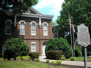
Established on June 2, 1870, Loudon County was created from portions of Roane, Monroe, and Blount Counties. On
September 5, the county court was organized, and the Loudon (formerly Blair's Ferry) town square was donated as the
site for the courthouse. The county court selected the building plan submitted by A. C. Bruce, and brothers J.
Wesley and Ira Napoleon Clark built it for $14,200. By September 1872 the courthouse was ready for occupancy and has
served since as the seat of government.
Comprising 229 square miles, Loudon County lies on both sides of the Tennessee River and extends north to the Clinch
River. The territory south of the river contains the fertile valleys of Sweetwater, Pond, Fork, and Town Creeks. To
the north are the broad bottoms of the Tennessee River. The Little Tennessee River also passes through the county.
The first occupants were Native Americans. The part of the county lying south of the rivers formerly belonged to the
Hiwassee District and was not settled by white men until 1819-20, but settlements were made on the north banks of
the Tennessee and the Little Tennessee before 1800. Find more from the Tennessee Encyclopedia of History and Culture:
LOUDON COUNTY
Geography: Land and Water
As reported by the Census Bureau, the county has a total area of 247 square miles (640 km2), of which 229 square miles
(590 km2) is land and 18 square miles (47 km2) (7.3%) is water.
The Little Tennessee River joins the Tennessee River at Lenoir City. The lower part of the Little Tennessee River is part of Tellico Lake,
created by Tellico Dam near the mouth of the river. Fort Loudoun Dam spans the Tennessee River just upstream from its confluence with the
Little Tennessee, creating Fort Loudoun Lake. The section of the river downstream from Fort Loudoun Dam is part of Watts Bar Lake.
Neighboring Counties
Bordering counties are as follows:
- Knox County (northeast)
- Blount County (east)
- Monroe County (south)
- McMinn County (southwest)
- Roane County (northwest)
Education


Click Image to Enlarge
