Morgan County, Tennessee
Morgan County Education, Geography, and History

Morgan County is a county located in the state of Tennessee. Based on the 2010 census, the population was 21,987. Its county seat is
Wartburg.
Morgan County is part of the Knoxville, TN Combined Statistical Area
Etymology - Origin of Morgan County Name
Named in honor of Daniel Morgan (1736-1802), American Revolutionary War officer who commanded the troops that defeated the British at Cowpens, and US congressman from Virginia.
Demographics:
County QuickFacts: CensusBureau Quick Facts
History of Morgan County
Created 1817 from Anderson and Roane counties; named in honor of Daniel Morgan (1736-1802), American Revolutionary War officer who commanded the troops that defeated the British at Cowpens, and US congressman from Virginia.
Morgan County was formed in 1840 from Anderson and Roane counties
(Acts of Tennessee 1817, Chapter 38).
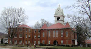
There were fires at the Morgan County courthouse in 1826, 1870 and 1904.
Tennessee Encyclopedia of History and Culture
Organized as Tennessee's thirty-ninth county by legislative act in 1817, Morgan County came primarily from
territory removed from Roane County. The new county ran diagonally across the Cumberland Plateau from the eastern
escarpment to the Kentucky line to the north. The county and the county seat, Montgomery, were named in honor of
Revolutionary War hero General Daniel Morgan and Major Lemuel P. Montgomery, a Knoxville resident who was killed in
the battle of Horseshoe Bend during the Creek Indian Wars of 1814.
The first permanent settlers, Samuel and Martin Hall, arrived soon after the Third Tellico Treaty opened the area to
settlement in 1805. Many of the early settlers, like Samuel Hall, were Revolutionary War veterans who claimed land
grants from North Carolina for military service. Early settlers made their homes in isolated mountain valleys where
the soil was relatively fertile and game abundant. The soil and the topography of the county reduced the land
suitable for agriculture to less than half of the 345,000 acres within the county's boundaries. Although two rivers,
the Obed and the Emory, flow through the county, neither was suitable for transportation of goods. As a result,
settlers engaged in subsistence farming, and settlement and development were extremely slow. The lack of significant
agricultural production limited slavery in Morgan County. The 1820 census registered 46 slaves; by 1860 the number
of slaves had grown to 120, distributed among 25 owners. Find more from the Tennessee Encyclopedia of History and Culture:
MORGAN COUNTY
Geography: Land and Water
As reported by the Census Bureau, the county has a total area of 522 square miles (1,353 km2), of which, 522
square miles (1,352 km2) of it is land and 0.4 square miles (1 km2) of it (0.07%) is water. The county is known for
its rugged mountain terrain, and cold mountain streams and rivers. The Crab Orchard Mountains comprise a large area
of the county, including many wilderness areas, Frozen Head State Park, and Lone Mountain State Forest.
Neighboring Counties
Bordering counties are as follows:
- Scott County (northeast)
- Anderson County (east)
- Roane County (south)
- Cumberland County (southwest)
- Fentress County (northwest)
Education


