


Click Image to Enlarge
Tennessee Counties
There are ninety-five counties in the State of Tennessee. The oldest county is Washington County, founded in 1777. The most recently formed county is Chester County (1879)Putnam County, Tennessee
Putnam County Education, Geography, and History
Putnam County is a county located in the state of Tennessee. Based on the 2010 census, the population was 72,321. Its county seat is
Cookeville.
Putnam County is part of the Cookeville, TN Micropolitan Statistical Area.
Etymology - Origin of Putnam County Name
Named in honor of Israel Putnam (1718-1790), French and Indian War soldier and commander at the Revolutionary War battles of Bunker Hill and Long Island.
Demographics:
County QuickFacts: CensusBureau Quick Facts
History of Putnam County
Created 1854 from Fentress, Jackson, Smith, White and Overton counties; named in honor of Israel Putnam (1718-1790), French and Indian War soldier and commander at the Revolutionary War battles of Bunker Hill and Long Island.
Putnam County was formed in 1854 from Fentress, Jackson, Overton, Smith and White counties (Acts of Tennessee 1842, Chapter 169; Acts of Tennessee 1854, Chapter 320 re-established Putnam County).
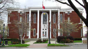
There were fires at the Putnam County courthouse in the 1860s and in 1898.
Tennessee Encyclopedia of History and Culture
The Tennessee General Assembly first created Putnam County in 1842 from Jackson, Overton, Fentress, and White
Counties, but an 1844 injunction charged that it violated state constitutional requirements. In 1854 the general
assembly reestablished the county, although it was harried by boundary disputes for decades. The new county seat,
Cookeville, was named after Richard F. Cooke, whose efforts were critical to the county's second attempt at
creation. Putnam County's name honors Revolutionary War general Israel Putnam.
Putnam County is located in the Upper Cumberland region. It spreads across three major geographic divisions of
Tennessee: the Cumberland Plateau, the Highland Rim, and the Central Basin. Most of the county falls in the Highland
Rim. A principal early nineteenth-century east-west migration route, the Walton Road, passes through the length of
Putnam County. Many families stopped at this point about midway between Knoxville and Nashville on their journey
along the Walton Road. There they established small subsistence farms, growing corn and other crops in the generally
poor soil. By 1860 the population had risen to 8,591, including 718 blacks and 33 Native Americans. Settlement
halted during the Civil War, when Putnam County civilians were harassed by both Confederate and Unionist guerrilla
attacks that destroyed farmland and homes. Find more from the Tennessee Encyclopedia of History and Culture:
PUTNAM COUNTY
Geography: Land and Water
As reported by the Census Bureau, the county has a total area of 403 square miles (1,043 km2), of which, 401
square miles (1,039 km2) of it is land and 2 square miles (4 km2) of it (0.37%) is water.
Neighboring Counties
Bordering counties are as follows:
- Overton County (northeast)
- Cumberland County (east)
- White County (south)
- DeKalb County (southwest)
- Smith County (west)
- Jackson County (northwest)
Education
Cookeville, the largest town in Putnam County, is the home of Tennessee Technological University, which is known for engineering,
education, business, and the arts. The largest college at Tennessee Tech is the College of Arts and Sciences.
The Putnam County school system enrolls approximately 11,000 students in 18 schools throughout the county. All schools are accredited.
Cookeville High School is the largest non-metropolitan school in the state and is one of only eight high schools in the state to offer the
International Baccalaureate program


Click Image to Enlarge
