


Click Image to Enlarge
Tennessee Counties
There are ninety-five counties in the State of Tennessee. The oldest county is Washington County, founded in 1777. The most recently formed county is Chester County (1879)Van Buren County, Tennessee
Van Buren County Education, Geography, and History
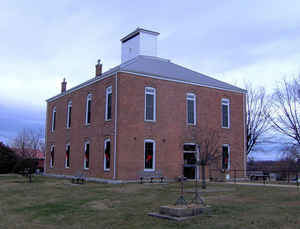
Van Buren County is a county located in the state of Tennessee. Based on the 2010 census, the population was 5,548, making it the second-least populous county in Tennessee. Its county seat is Spencer.
Etymology - Origin of Van Buren County Name
Named in honor of Martin Van Buren (1782-1862), attorney general and governor of New York, US senator from New York, US secretary of state, eighth US president.
Demographics:
County QuickFacts: CensusBureau Quick Facts
History of Van Buren County
Created 1840 from Warren and White counties; named in honor of Martin Van Buren (1782-1862), attorney general and governor of New York, US senator from New York, US secretary of state, eighth US president.
Van Buren County was formed in 1840 from Warren and White counties. (Acts of Tennessee 1839-40, Chapter 59).
Tennessee Encyclopedia of History and Culture
Van Buren County encompasses 274 square miles straddling the Cumberland Plateau and the eastern Highland Rim. The
western 30 percent of the county stands 960 feet above sea level; its limestone outcroppings have resulted in
numerous caves. The best known, Big Bone Cave, was important in the early settlement period. In 1811 the discovery
of bones of a giant sloth in the cave provided its name; remnants of a Pleistocene jaguar were unearthed there as
well. The US Department of the Interior designated the 334-acre site a Pleistocene vertebrate fossil site. It is
also listed on the National Register of Historic Places: in both the War of 1812 and the Civil War saltpeter was
mined there, and the well-preserved vats, tramways, and ladders remain in place today.
The other 70 percent of Van Buren County, the Plateau region, rises 800-1,000 feet higher than the western section
and is generally level except where streams have cut gorges (called gulfs) through the sandstone. The Caney Fork
River and its tributaries drain all of Van Buren County except for the southeast corner, which is drained by the
headwaters of Brush Creek. The Caney Fork also creates the northern border of the county, and the Rocky River serves
as part of its western boundary. Find more from the Tennessee Encyclopedia of History and Culture:
VAN BUREN COUNTY
Geography: Land and Water
As reported by the Census Bureau, the county has a total area of 275 square miles (711 km2), of which, 273
square miles (708 km2) of it is land and 1 square miles (3 km2) of it (0.42%) is water.
Neighboring Counties
Bordering counties are as follows:
- White County (north)
- Cumberland County (northeast)
- Bledsoe County (east)
- Sequatchie County (south)
- Warren County (west)
Education


Click Image to Enlarge
