


Click Image to Enlarge
Tennessee Counties
There are ninety-five counties in the State of Tennessee. The oldest county is Washington County, founded in 1777. The most recently formed county is Chester County (1879)Warren County, Tennessee
Warren County Education, Geography, and History
Warren County is a county located in the central part of the state of Tennessee. Based on the 2010 census, the population was 39,839. Its
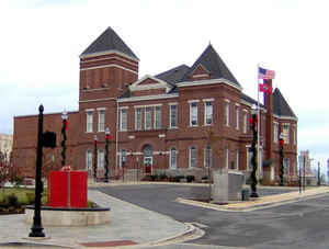
county seat is McMinnville.
Warren County comprises the McMinnville, TN Micropolitan Statistical Area.
Etymology - Origin of Warren County Name
Named in honor of Joseph Warren (1741-1775), Revolutionary War officer who sent Paul Revere on his famous midnight ride to Lexington in 1775, and who was killed at Bunker Hill.
Demographics:
County QuickFacts: CensusBureau Quick Facts
History of Warren County
Created 1807 from White, Jackson, Smith counties and Indian lands; named in honor of Joseph Warren (1741-1775), Revolutionary War officer who sent Paul Revere on his famous midnight ride to Lexington in 1775, and who was killed at Bunker Hill.
Warren County was formed in 1807 from Jackson, Smith & White counties and Indian lands. (Acts of Tennessee 1807, Chapter 28).
Tennessee Encyclopedia of History and Culture
The Tennessee General Assembly established Warren County on November 26, 1807; it was the thirtieth county
created in Tennessee. Settlers came to the area as early as 1800, and the new county was originally that portion of
White County (created in 1806) lying south of the Caney Fork River along the Highland Rim with portions on the
Cumberland Plateau on the east and in the Central Basin on the west. Warren County was organized in February 1808,
and in March 1810 the county court appointed commissioners to purchase a site for a county seat to be called
McMinnville.
Warren County was named for General Joseph Warren, the first general killed in the War of Independence. McMinnville
was named for Joseph McMinn, who was speaker of the Tennessee State Senate at the time the county was formed; later
he served as one of the state's outstanding governors. Settlement continued at a rapid pace, and in 1810 Warren
County contained 5,725 people; by 1830 it had grown to 15,351.
At the time of its creation, the county contained some 900 square miles, but this area was reduced to approximately
433 square miles from 1836 to 1844 by the creation of Cannon, Coffee, DeKalb, Van Buren, and Grundy Counties. The
Tennessee State Constitution of 1834 provided that, in the formation of new counties, no county boundary could be
closer than twelve miles from the county seat of the former county from which the new county was to be formed. Each
of the new counties established their boundaries exactly twelve miles from McMinnville, with the result that by 1844
Warren County had acquired its distinctive round shape and its nickname, "the round county." Find more from the Tennessee Encyclopedia of History and Culture:
WARREN COUNTY
Geography: Land and Water
As reported by the Census Bureau, the county has a total area of 434 square miles (1,124 km2), of which, 433
square miles (1,121 km2) of it is land and 1 square miles (4 km2) of it (0.32%) is water.
Hubbard's Cave, the largest gray bat hibernaculum in Tennessee with over 100,000 bats, is located in the county.
Neighboring Counties
Bordering counties are as follows:
- DeKalb County (north)
- White County (northeast)
- Van Buren County (east)
- Sequatchie County (southeast)
- Grundy County (south)
- Coffee County (southwest)
- Cannon County (northwest)
Education


Click Image to Enlarge
