DeKalb County, Alabama History
DeKalb County Education, Geography, and History
DeKalb County is a county of the state of Alabama. Based on the 2010 census, the population was 71,109. DeKalb County was created on January 9, 1836, from land ceded to the Federal government by the Cherokee Nation. Its county seat is Fort Payne. DeKalb was named in honor of Major General Baron Johan DeKalb.
Etymology - Origin of DeKalb County Name
It was named for Maj. Gen. John Baron DeKalb, a hero of the American Revolution.
Demographics:
County QuickFacts: CensusBureau Quick Facts
DeKalb County History
DeKalb County, Alabama
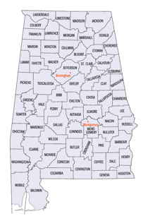
DeKalb county was formed by the Alabama legislature on January 9, 1836 from land ceded to the Federal government by the Cherokee Nation. It was named for Major Gen. John Baron DeKalb, a hero of the American Revolution. The county is located in the northeast corner of the state, and is bordered on the north by Jackson County, on the west by Marshall County, on the south by Etowah and Cherokee counties, and on the east by the State of Georgia. It currently encompasses 778 square miles. The county seat is Fort Payne. Other towns and communities include Collinsville, Crossville, Fyffe, Mentone, and Valley Head.
DeKalb County was the one time home of the famous Cherokee Native American Sequoyah.
The county's eastern edge, along the state line, was also the epicenter of an earthquake on April 29, 2003, measuring 4.6 on the Richter
scale. Power was knocked out in the area, mirrors and pictures thrown to the floor, foundations cracked, and one chimney fell to the ground.
It was felt over a significant portion of the southeastern states, including quite strongly in northeastern Alabama and neighboring
northwestern Georgia, and nearby eastern Tennessee (especially near Chattanooga). It was also felt slightly in western upstate South Carolina,
far west-southwestern North Carolina, south and southeastern Kentucky, and east-northeastern Mississippi.
On the whole, DeKalb County is a dry county. In 2005, a change in local laws enabled Fort Payne to become the only location in the county to
allow the legal sale of alcohol. Collinsville later allowed alcohol sales.
DeKalb County saw the highest death toll in Alabama during a massive
tornado system in late April 2011 April 25-28, 2011 tornado outbreak,
with 31 deaths reported in the county.
Geography: Land and Water
As reported by the Census Bureau, the county has a total area of 779 square miles (2,020 km2), of which 777 square miles (2,010 km2) is land and 1.6 square miles (4.1 km2) (0.2%) is water.
There are no major waterways in DeKalb County. Several tributaries of the Tennessee River, including South Sauty, Big Wills, and Town creeks, intersect the area.
Neighboring Counties
Bordering counties are as follows:
- Northeast: Dade County, Ga.; Walker County, Ga.
- East: Chattooga County, Ga.
- Southeast: Cherokee County
- Southwest: Etowah County
- West: Marshall County
- Northwest: Jackson County
Education


