


Click Image to Enlarge
Alabama Counties
Alabama currently has sixty-seven counties. The oldest county, Washington, was created on June 4, 1800, when what is now Alabama was then part of the Mississippi Territory. The newest county is Houston, created on February 9, 1903.Etowah County, Alabama History
Etowah County Education, Geography, and History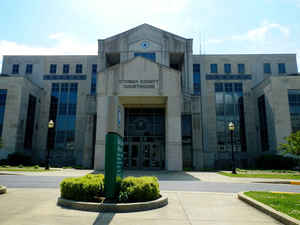
Etowah County is a county of the state of Alabama. Based on the 2010 census, the
population was 104,430. Etowah County was
created on December 7, 1866, and was formed from Blount County,
Calhoun County, Cherokee County, Dekalb County, Marshall County, and St.
Clair County. The county seat is Gadsden.
Etowah is named from a Cherokee word meaning "edible tree". In total area, it is the smallest county in Alabama, but one of the most densely
populated.
Etowah County comprises the Gadsden, AL Metropolitan Statistical Area.
Etymology - Origin of Etowah County Name
Etowah county was formed by the Alabama legislature on December 7, 1866 and was originally named Baine County in honor of General David W. Baine, a Confederate soldier from Lowndes County. The county was abolished on December 1, 1868 by the Constitutional Convention and re-established on the same day, under the name of Etowah, which is from the Cherokee language.
Demographics:
County QuickFacts: CensusBureau Quick Facts
Etowah County History
Etowah County, Alabama
Etowah county was formed by the Alabama legislature on December 7, 1866, and was originally named Baine County in honor of General David W. Baine, a Confederate soldier from Lowndes County. The county was abolished on December 1, 1868 by the Constitutional Convention and re-established on the same day, under the name of Etowah, which is from the Cherokee language. Etowah County is located in the northeastern section of the state, in the southern Appalachians. It is bordered by Marshall, DeKalb, Cherokee, Calhoun, St. Clair, and Blount Counties. It currently encompasses 542 square miles. Sand Mountain and Lookout Mountain are located in Etowah County. Gadsden is the county seat, named after Colonel James Gadsden, distinguished soldier, diplomat, and railroad president. Other towns and communities include Attalla and Rainbow City.
An F4 tornado struck here on Palm Sunday March 27, 1994. It destroyed Piedmont's Goshen United Methodist Church twelve minutes after the National Weather Service of Birmingham issued a tornado warning for northern Calhoun, southeastern Etowah, and southern Cherokee
Geography: Land and Water
As reported by the Census Bureau, the county has a total area of 549 square miles (1,420 km2), of which 535 square miles (1,390 km2) is land and 14 square miles (36 km2) (2.5%) is water. It is the smallest county by area in Alabama.
The Coosa River runs north to south through the eastern half of the county, and two of its tributaries, Black and Big Wills creeks, intersect the area. In 1966, Alabama Power constructed H. Neely Henry Dam on the Coosa River, creating the H. Neely Henry Lake, which covers the southern tip of Etowah County. In addition, both the Sand Mountain and Lookout Mountain ranges are located in the county.
Neighboring Counties
Bordering counties are as follows:
- Northeast: DeKalb County; Cherokee County
- Southeast: Calhoun County
- Southwest: St. Clair County
- West: Blount County
- Northwest: Marshall County
Education


Click Image to Enlarge
