


Click Image to Enlarge
Alabama Counties
Alabama currently has sixty-seven counties. The oldest county, Washington, was created on June 4, 1800, when what is now Alabama was then part of the Mississippi Territory. The newest county is Houston, created on February 9, 1903.Lowndes County, Alabama History
Lowndes County Education, Geography, and History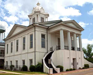
Lowndes County is a county of the state of Alabama. Based on the 2010 census, the
population was 11,299. The county
seat is Hayneville. Lowndes County was created
on January 20, 1830 from parts of Butler County, Dallas County and
Montgomery County.
The county is named in honor of William Lowndes, a member of the United States Congress from South Carolina.
Lowndes County is part of the Montgomery, AL Metropolitan Statistical Area.
Etymology - Origin of Lowndes County Name
The county is named for South Carolina statesman William Lowndes.
Demographics:
County QuickFacts: CensusBureau Quick Facts
Lowndes County History
Lowndes County, Alabama
Lowndes county
was formed by an act of the Alabama General Assembly on January 20, 1830.
The county was formed from parts of Montgomery, Dallas, and Butler counties. Lowndes County is located in the south-central portion of the state, in the Black Belt. It encompasses 714 square miles.
The county is named for South Carolina statesman William Lowndes. The area has a rich aboriginal history and was a center of plantation life in Alabama. The county seat is Hayneville. Other significant towns include White Hall, Letohatchee, Lowndesboro and Fort Deposit.
Following Reconstruction and years in which blacks continued to be elected to local office, the white-Democrat dominated state legislature
gained passage of a new constitution in 1901 that effectively disfranchised most blacks and many poor whites. Requirements were added for
payment of a cumulative poll tax before registering to vote, difficult for poor people to manage; and literacy tests (with a provision for a
grandfather clause to exempt illiterate white voters from being excluded.) The number of black voters fell dramatically, as did poor white
voters.
Population has declined by two thirds since the 1900 high of more than 35,000. The effects of mechanization and the boll weevil infestation,
which decimated the cotton crops and reduced the need for farm labor in the 1920s and 1930s, caused the loss of jobs. Many blacks left the
county in first half of the 20th century, in Great Migration to northern and midwestern industrial cities, where there were work
opportunities. Young people continue to leave for towns and cities.
Geography: Land and Water
As reported by the Census Bureau, the county has a total area of 725 square miles (1,880 km2), of which 716 square miles (1,850 km2) is land and 9.2 square miles (24 km2) (1.3%) is water.
The Alabama River and its middle tributaries flow throughout Lowndes County. The Alabama River serves as the unifier of Alabama's eastern and western rivers. More than 144 species of fish have been identified in the Alabama River. The river provides both economic and recreational opportunities for Lowndes County.
Neighboring Counties
Bordering counties are as follows:
- North: Autauga County
- East: Montgomery County
- Southeast: Crenshaw County
- South: Butler County
- Southwest: Wilcox County
- Northwest: Dallas County
Education
Lowndes County is served by Lowndes County Public Schools, which include:
- Calhoun High School
- Central Elementary School
- Central High School
- Fort Deposit Elementary School
- Hayneville Middle School
- Jackson-Steele Elementary School
- Lowndes County Middle School.


Click Image to Enlarge
