


Click Image to Enlarge
Alabama Counties
Alabama currently has sixty-seven counties. The oldest county, Washington, was created on June 4, 1800, when what is now Alabama was then part of the Mississippi Territory. The newest county is Houston, created on February 9, 1903.Marshall County, Alabama History
Marshall County Education, Geography, and History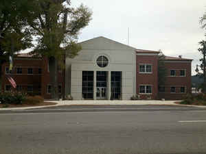
Marshall County is a county of the state of Alabama. Based on the 2010 census, the population was 93,019. Marshall County was created on January 9, 1836 and was formed from Jackson County and Blount County and Cherokee Cession of 1836. The county seat is Guntersville. A second courthouse is in Albertville. The county name is in honor of John Marshall, famous Chief Justice of the United States.
Marshall County comprises the Albertville, AL Micropolitan Statistical Area, which is also included in the Huntsville-Decatur-Albertville, AL Combined Statistical Area.
Etymology - Origin of Marshall County Name
Marshall county was named in honor Chief Justice John Marshall.
Demographics:
County QuickFacts: CensusBureau Quick Facts
Marshall County History
Marshall County, Alabama
On January 9, 1836, Marshall county was created and named after the honor Chief Justice John Marshall. The county is located in the northeastern part of the state on the Appalachian ridge. It encompasses 567 square miles. The Tennessee River cuts through the northern part of the county, creating Guntersville Lake.
The county seat was established in 1836 at Claysville, moved to Marshall in 1838, to Warrenton in 1841, and finally located at Guntersville in 1848. Other towns in the county include Arab, Albertville and Boaz.
Marshall County is a dry county, with the exception of the four cities of Albertville, Arab, Guntersville, and Boaz.
Geography: Land and Water
As reported by the Census Bureau, the county has a total area of 623 square miles (1,610 km2), of which 566 square miles (1,470 km2) is land and 57 square miles (150 km2) (9.2%) is water. The Tennessee River runs both north and south within the county.
The Tennessee River runs southwest from the northeast portion of the county and exits in the northwest. The Tennessee River Basin is considered one of the most biologically diverse river systems in the United States, and many of its plant and animal species are endangered or at-risk. The Paint Rock River forms a portion of the county's northern boundary, and several tributaries of the Black Warrior River run through the southwest part of the county.
Neighboring Counties
Bordering counties are as follows:
- Northeast: Jackson County
- East: DeKalb County
- Southeast: Etowah County
- Southwest: Blount County; Cullman County
- West: Morgan County
- Northwest: Madison County
Places of interest
Marshall County is home to numerous outdoor recreation areas including Lake Guntersville State Park, Cathedral Caverns State Park, and Buck's Pocket State Park.
Education


Click Image to Enlarge
