


Click Image to Enlarge
Alabama Counties
Alabama currently has sixty-seven counties. The oldest county, Washington, was created on June 4, 1800, when what is now Alabama was then part of the Mississippi Territory. The newest county is Houston, created on February 9, 1903.Tallapoosa County, Alabama History
Tallapoosa County Education, Geography, and History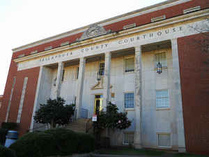
Tallapoosa County is a county of the state of Alabama. Based on the 2010 census, the population was 41,616. Tallapoosa County was created on December 18, 1832, from land acquired from the Creek Cession of Mar 24, 1832. The county seat is Dadeville. The name Tallapoosa is of Creek origin, many Creek villages were located along the banks of the lower river before Indian Removal in the 19th century.
Etymology - Origin of Tallapoosa County Name
The county derives its name from the Tallapoosa River. Tallapoosa is believed to mean "pulverized rock," in the Choctaw Indian language.
Demographics:
County QuickFacts: CensusBureau Quick Facts
Tallapoosa County History
Tallapoosa County, Alabama
Tallapoosa county was formed by the Alabama legislature on December 18,
1832, from land acquired from the Creek Cession of March 24, 1832 Tallapoosa County received its present dimensions in 1866. The county derives its name from the Tallapoosa River. Tallapoosa is believed to mean "pulverized rock," in the Choctaw Indian language. Tallapoosa County is located in the east-central part of the state and is bordered by Clay, Randolph, Chambers, Lee, Macon, Elmore, and Coosa counties.
The county lies almost entirely in the Piedmont plateau, immediately south of the Appalachian plateau province. It encompasses 701 square miles. From 1832-38, the county seat was at Okfuskee. Since 1838, it has been at Dadeville, which was named for Major Francis Langhorne Dade who died in the Seminole War. Horseshoe Bend National Military Park and Lake Martin are located in Tallapoosa County. Other towns and communities include Alexander City and Camp Hill.
Geography: Land and Water
As reported by the Census Bureau, the county has a total area of 766 square miles (1,980 km2), of which 717 square miles (1,860 km2) is land and 50 square miles (130 km2) (6.5%) is water. The county is intersected by the Tallapoosa River.
The Tallapoosa River runs north to south, bisecting the county. The rough falls of the river made early navigation difficult and delayed industrial development in the area. Today, however, these falls allow for a number of increasingly popular whitewater sporting activities.
Neighboring Counties
Bordering counties are as follows:
- North: Clay County
- Northeast: Randolph County
- East: Chambers County
- Southeast: Lee County
- South: Macon County
- Southwest: Elmore County
- West: Coosa County
Education


Click Image to Enlarge
