

Click Image to Enlarge
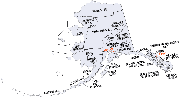
Alaska Boroughs
Alaska is divided into nineteen organized boroughs and one "Unorganized Borough." The Borough Act of 1961 created "The Unorganized Borough" including all of Alaska not within a Unified, Home rule, First class or Second class Borough. The newest borough is Petersburg incorporated after voters approved borough formation in December 2012. Alaska and Louisiana are the only states that do not call their first-order administrative subdivisions counties (Louisiana uses parishes instead)Aleutians East Borough, Alaska
Aleutians East Borough Education, Geography, and History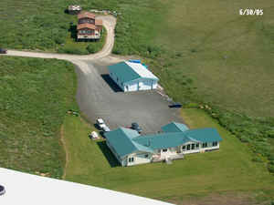
Aleutians East Borough is a 2nd class borough located in the state of Alaska. Based on the 2010 census, the borough had a population of 3,141. The borough was created on October 23, 1987. The borough seat is Sand Point. The Aleutians East Borough was named for the Aleutian Islands.
Etymology - Origin of Aleutians East Borough Name
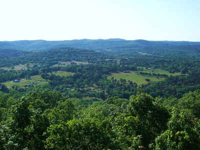
Aleutians East Borough comprises the westernmost portion of the Alaska Peninsula, and a number of the Aleutian Islands, from which the borough name is derives.
Demographics:
County QuickFacts: CensusBureau Quick Facts
History of Aleutians East Borough, Alaska
According to the finding of archaeological evidence, the area of the
Aleutians East Borough has been inhabited by the Unanga since the last ice age some time ago. Early contact was with Russian fur traders who sought sea otters in these islands. Whaling, fishing and cannery operations brought an influx of Scandinavian and European fishermen in the early 1900's. During World War II the area was a strategic military site for the Aleutian Campaign, and many locals were evacuated to Ketchikan.
The population of the community consisted of 38.6% Alaska Native or part Native. The area's rich resources have cultivated an extremely diverse population of non-Natives, Natives and Asians. The Unanga were called "Aleut" by Russian traders. "Unangas" spoke with a western dialect, and "Unangan"
spoke with and eastern dialect.
Geography: Land and Water
As reported by the Census Bureau, the borough has a total area of 15,010 square miles (38,900 km2), of which 6,982 square miles (18,080
km2) is land and 8,082 square miles (20,930 km2) (53.5%) is water.
Aleutians East Borough is located at 57° north latitude and 162° west longitude. It comprises the westernmost portion of the Alaska Peninsula,
and a small number of the Aleutian Islands, from which the borough name derives. Also included are the Shumagin Islands, as well as the Pavlof
Islands and the Sanak Islands. In all, about 63.9 percent of its land area comprises land on the Alaska Peninsula, while 36.1 percent is on
the numerous islands. There are five incorporated cities and two unincorporated villages within the borough.
Temperatures range from -9 to 76 degrees Fahrenheit. Annual precipitation is 33 inches and annual snowfall is 52 inches.
Neighboring Boroughs
Bordering boroughs are as follows:
- Northeast: Lake and Peninsula Borough
- Southeast: North Pacific Ocean
- West: Aleutians West census area
- Northwest: Bering Sea
Government and infrastructure
This information is available on a community basis. Communities located within the borough include: Akutan, Belkofski, Cold Bay, False Pass, King Cove, Nelson Lagoon, Pauloff Harbor, Sand Point, and Unga. There are 7 schools located in the borough, attended by 273 students. The Sand Point Clinic is managed by Eastern Aleutian Tribes, Inc. and inhabited a new facility in 2006. The clinic is staffed by low-level professionals and Community Health Aide/Practitioners or CHAs. The CHA role is unique to Alaska and Native Health Care
Education


Click Image to Enlarge
