

Click Image to Enlarge
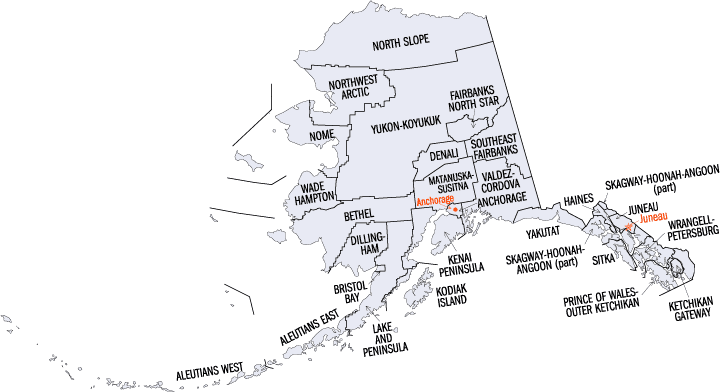
Alaska Boroughs
Alaska is divided into nineteen organized boroughs and one "Unorganized Borough." The Borough Act of 1961 created "The Unorganized Borough" including all of Alaska not within a Unified, Home rule, First class or Second class Borough. The newest borough is Petersburg incorporated after voters approved borough formation in December 2012. Alaska and Louisiana are the only states that do not call their first-order administrative subdivisions counties (Louisiana uses parishes instead)North Slope Borough, Alaska
North Slope Borough Education, Geography, and History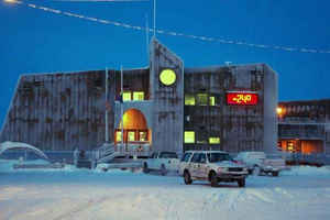
North Slope Borough is a borough located largely in the North Slope region of the state of Alaska. Based on the 2010 census, the population was 9,430. North Slope was created in 1972. The borough seat is Barrow. The North Slope named after the North Slope region where it is located.
Etymology - Origin of North Slope Borough Borough Name
North Slope NSB spans an area of approximately 89,000 square miles of the North Slope region, all of it in the high Arctic
Demographics:
County QuickFacts: CensusBureau Quick Facts
History of North Slope Borough, Alaska
The North Slope Borough is the largest county-level political subdivision in the United States by area. Although the neighboring Yukon-Koyukuk Census Area is larger in area, it has no borough-level government. The area is roughly the same size as the state of Michigan.
The North Slope Borough, Alaska, was one of the first in the world to use GIS in a local government's decision making process. Its GIS Division was established in 1982 as a result of the insight of the late Mayor Eben Hopson. He was convinced by early geo-processing enthusiasts from ESRI, the State of Alaska Department of Natural Resources (DNR), the National Oceanic and Atmospheric Administration (NOAA), and the Army Corps of Engineers that GIS would become a vital tool for meeting the requirements of NSB code in terms of resource mapping, zoning, tax assessment census information, and documenting traditional land use.
In the early 1978, the NSB's Beaufort Sea Coastal Zone Management plan clearly demonstrated that mapping products play a fundamental role in resolving resource conflicts. In 1982, close to $4 million was appropriated to establish the NSB Department of Planning and Community Services Geographic Information System Division (NSB/GIS). The goal of the GIS was to provide the NSB with the tools and information to track and assess cumulative impacts to the marine and terrestrial subsistence resources and to support Arctic science research. This daunting task (the North Slope NSB spans an area of approximately 89,000 square miles, all of it in the high Arctic) was made even more difficult by first establishing the GIS program in Anchorage, Alaska, and 10 years later moving the entire operation to Barrow, Alaska, approximately 250 miles north of the Arctic Circle.
Nevertheless, the NSB/GIS program is booming. In addition to collecting data, creating maps, and performing analysis in support of Planning Department activities, the NSB/GIS provided information and products to many other NSB departments. The GIS creates products that effectively communicate NSB concerns to federal and State agencies; contributes work to private entities, such as the Alaska Geographic Atlas and the Barrow Arctic Science Consortium; and supports temperature research projects within the Barrow Environmental Observatory. Also, GIS services and products are available to all North Slope NSB residents.
Since its earliest days the NSB/GIS has used a wide range of ESRI software to accomplish its day-to-day and long-term projects. Arc Info was recently migrated from the UNIX to Windows NT platforms. Application development using Arc View GIS and Map Objects is under way. And the Department of Permitting, Tax Audit, and Assessing is deploying an Intranet using ESRI's Internet Map Server (IMS) technology.
Geography: Land and Water
North Slope Borough is a borough located largely in the North Slope region of the state of Alaska. As of 2000, the inhabitants are 7,385. The borough has a total area of 94,763 mi2. 88,817 mi2 of it is made up of land. 5,946 mi2 of it is made up of water.
As reported by the Census Bureau, the borough has a total area of 94,796 square miles (245,520 km2), of which 88,695 square miles
(229,720 km2) is land and 6,101 square miles (15,800 km2) (6.4%) is water. The borough is larger than 39 states.
Its western coastline is along the Chukchi Sea, while its eastern shores (beyond Point Barrow) are on the Beaufort Sea.
The North Slope Borough is the largest county-level political subdivision in the United States by area, with a larger land area than that of
the state of Utah (itself the 13th largest state in the nation). Although the adjacent Yukon-Koyukuk Census Area is larger in area, it has no
borough-level government. The borough is also the third-least densely populated county-level entity in the United States (after the
Yukon-Koyukuk Census Area and the Lake and Peninsula Borough).
Neighboring Boroughs:
- Yukon-Koyukuk Census Area, Alaska - southeast
- Northwest Arctic Borough, Alaska - southwest
Also shares eastern border with the Yukon Territory, Canada.
Education


Click Image to Enlarge
