


Click Image to Enlarge
Illinois Counties
There are one hundred and two counties in Illinois. St. Clair County was the first county established in what is today Illinois. Most counties in Illinois were named after early American leaders, especially of the American Revolutionary War, as well as soldiers from the Battle of Tippecanoe and the War of 1812.Bureau County, Illinois
Bureau County Education, Geography, and History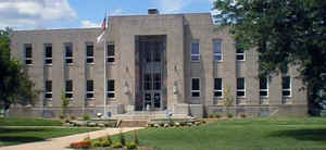
Bureau County is a county located in the state of Illinois. Based on the 2010 census, the
population was 34,978. Bureau County was
created on February 28, 1837. The county
seat is
Princeton. The county is named for Pierre de Bureo,
Frenchman, North American fur trader.
Bureau County is part of the Ottawa-Peru, IL Micropolitan Statistical Area, which is also included in the Chicago-Naperville, IL-IN-WI
Combined Statistical Area. Hennepin Canal Parkway State Park is located partly in this county.
Etymology - Origin of Bureau County Name
The county is named for Pierre de Bureo, French trader with Indians.
Demographics:
County QuickFacts: CensusBureau Quick Facts
Bureau County History
At the formation of Bureau County; its population was estimated at about 2,000 mainly scattered about the vicinity of
the towns mentioned above. . The large county of Putnam had grown cumbersome as the number of its inhabitants increased;
and a division was now imperatively called for. The proper petitions were forwarded to the Legislature; and on the 28th
of February, 1837, an act was approved creating the county of Bureau. (This name though French, is said to be derived
from that of some Indian chief. Hennepin Herald, Feb. 1847.)
Its boundaries were defined as "beginning at the northeast corner of Putnam county, running thence south on the east
boundary line of said conty to the centre of the main channel of the Illinois river to the place where the line dividing
townships fourteen and fifteen north intersects said river, thence west on said line to the west line of said county,
thence north of the western line of said county to the northern boundary thereof, and thence east with said county line
to the place of beginning." A considerable county was thus set off, embracing 814 square miles. Additions have been made
since, from the western border of Putnam, so that the county now comprises nearly 25 townships.
The History of Bureau County (Taken From the Earliest Historical Facts of Marshall-Putnam Counties, Also Bureau and Stark Counties,
Compiled and Published by Mr. Henry A. Ford, 1860)
Chapter II: The History of Illinois 1690-1825 and Chapter V: The Black Hawk War
Chapter I: European Discovery in the West
Reminiscences of Bureau County : in two parts. (Matson, N.. Princeton, Ill.. Republican Book and Job Office. 1872. )
- Part One: Table of Contents All Chapters are Now Online
Geography: Land and Water
As reported by the Census Bureau, the county has a total area of 873 square miles (2,262 km2), of which 869 square miles (2,250 km2) is land and 5 square miles (12 km2) (0.54%) is water.
Bureau county is located in north Illinois. Big Bureau Creek is the main body of
water. Mautino State Fish and Wildlife Area is located in this county.
Neighboring Counties
Bordering counties are as follows:
- Northeast: Lee County
- East: La Salle County
- Southeast: Putnam County; Marshall County
- Southwest: Stark County
- West: Henry County
- Northwest: Whiteside County
Education


Click Image to Enlarge
