


Click Image to Enlarge
Illinois Counties
There are one hundred and two counties in Illinois. St. Clair County was the first county established in what is today Illinois. Most counties in Illinois were named after early American leaders, especially of the American Revolutionary War, as well as soldiers from the Battle of Tippecanoe and the War of 1812.Carroll County, Illinois
Carroll County Education, Geography, and History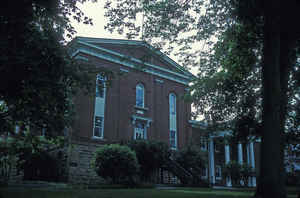
Carroll County is a county located in the state of Illinois. Based on the 2010 census, the population was 15,387. Carroll County was created on February 22, 1839. The county seat is Mount Carroll. The county is named for Charles Carroll of Carrollton (1737-1832), signed the Declaration of Independence on behalf of Maryland.
Etymology - Origin of Carroll County Name
Carroll County was organized in 1839, and was named for Charles Carroll, a wealthy landowner and politician from Maryland. He was one of the men who signed the Declaration Of Independence, and incidentally, was the last of the signers to die. The honor of naming the county was bestowed upon Isaac Chambers, the first settler in the county. Since Charles Carroll was one of the political heroes of the day, and since many settlers were from Maryland, Mr. Chambers decided to name the county after him.
Demographics:
County QuickFacts: CensusBureau Quick Facts
Carroll County History
Carroll County was created on February 22, 1839 (Laws, 1839, p. 160) and was formed from Jo Daviess County.
Present area, or parts of it, formerly included in: JoDaviess County (1827-1839), Putnam County (1825-1827), Henry
County (1825-1827), Fulton County (1823-1825), Pike County (1821-1823), Madison County (1812-1821) and St. Clair
County (1795-1812). The County was named for Charles Carroll of Carrollton, Illinois, a statesman of the
Revolutionary period, signer of the Declaration of Independence, and United States Senator from Maryland.
The County Seat is Mount Carroll . Prior County Seats was Savanna (1839-1843) and Mt. Carroll (1843-Present).
Geography: Land and Water
As reported by the Census Bureau, the county has a total area of 1,206 km2 (466 sq mi). 1,150 km2 (444 sq mi) of it is land and 56 km2 (22 sq mi) of it (4.63%) is water.
Carroll county is located in north Illinois. The Mississippi Palisades State Park is in this county,
just north of the city of Savanna. Part of the Savanna Army Depot is located in this county.
Neighboring Counties
Bordering counties are as follows:
- Northeast: Stephenson County
- East: Ogle County
- South: Whiteside County
- Southwest: Clinton County, Iowa
- West: Jackson County, Iowa
- Northwest: Jo Daviess County
Education
- Chadwick-Milledgeville Community Unit School District 399
- Eastland Community Unit School District 308
- Pearl City Community Unit School District 200
- West Carroll Community Unit School District 314


Click Image to Enlarge
