


Click Image to Enlarge
Illinois Counties
There are one hundred and two counties in Illinois. St. Clair County was the first county established in what is today Illinois. Most counties in Illinois were named after early American leaders, especially of the American Revolutionary War, as well as soldiers from the Battle of Tippecanoe and the War of 1812.De Witt County, Illinois
De Witt County Education, Geography, and History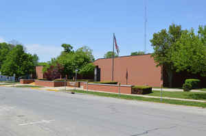
DeWitt County is a county located in the state of Illinois. Based on the 2010 census, the
population was 16,561. The county was created in 1839.
The county seat is Clinton. DeWitt county
is named in honor of the seventh Governor of New York
State, DeWitt Clinton.
DeWitt County is included in the Bloomington, IL Metropolitan Statistical Area.
The US Census Bureau and the USGS list the county's name as De Witt, although the county uses the name DeWitt
Etymology - Origin of De Witt County Name
The County was named for DeWitt Clinton, a distinguished lawyer, financier and statesman, Mayor of the city and Governor of the State of New York, United States Senator and chief promoter of the Erie Canal. The County Seat is Clinton (1939-Present).
Demographics:
County QuickFacts: CensusBureau Quick Facts
DeWitt County History
DeWitt County was created on March 1, 1839 (Laws, 1839, p. 199) and was formed from Macon and McLean Counties.
Present area, or parts of it, formerly included in: McLean County (1827-1839), Macon County (1831-1839), Tazewell
County (1827-1831), Shelby County (1827-1831), Fayette County (1821-1827), Clark County (1819-1821), Crawford County
(1816-1819), Edwards County (1815-1816), Madison County (1812-1815), St. Clair County (1801-1812) and Knox,
Northwest Territory (1790-1801).
Situated in the central portion of the State; has an area of 405 square miles and a population (1900) of 18,972. the land was originally owned by the Kickapoos and Pottawatomies, and not until 1820 did the first permanent white settlers occupy this region. The first to come were Felix Jones, Prettyman Marvel, William Cottrell, Samuel Glenn, and the families of Scott, Lundy and Coaps. Previously however, the first cabin had been built on the site of the present Farmer City by Nathan Clearwater. Zion Shugest erected the earliest grist-mill and Burrell Post the first saw-mill in the county. Kentuckians and Tennesseeans were the first immigrants, but not until the advent of settlers from Ohio did permanent improvements begin to be made. In 1835 a school house and Presbyterian church were built at Waynesville. The county was organized in 1839, and - with its capitol (Clinton) - was named after one of New York's most distinguished Governors. It lies within the great "corn belt" and is well watered by Salt Creek and its branches. Most of the surface is rolling prairie, interspersed with woodland. Several lines of railway (among them the Illinois Central) cross the county. Clinton had a population of 2,598 in 1890, and Farmer City, 1,367. Both are railroad centers and have considerable trade.
Geography: Land and Water
As reported by the Census Bureau, the county has a total area of 405 square miles (1,049 km2), of which 398 square miles (1,030 km2) is land and 8 square miles (20 km2) (1.87%) is water.
Dewitt county is located close to the center of Illinois. Clinton
Lake State Recreation Area is located in this county.
Neighboring Counties
Bordering counties are as follows:
- North: McLean County
- Southeast: Piatt County
- South: Macon County
- West: Logan County
Education


Click Image to Enlarge
