


Click Image to Enlarge
Illinois Counties
There are one hundred and two counties in Illinois. St. Clair County was the first county established in what is today Illinois. Most counties in Illinois were named after early American leaders, especially of the American Revolutionary War, as well as soldiers from the Battle of Tippecanoe and the War of 1812.Edwards County, Illinois
Edwards County Education, Geography, and History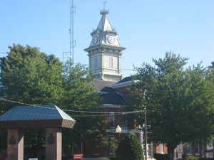
Edwards County is a county located in the state of Illinois. Based on the 2010 census, the population was 6,721. Edwards County was created on November 28, 1814. The county seat is Albion. The county is named for Ninian Edwards (1775-1833), third Governor of the State of Illinois and only governor of the Illinois Territory.
Etymology - Origin of Edwards County Name
The County was named for Ninian Edwards, Governor of the Illinois Territory and the third Governor of the State of Illinois. Edwards served as Territorial Governor from May 27, 1809 to October 6, 1818 and Governor of the State of Illinois from December 6, 1826 to December 6, 1830.
Demographics:
County QuickFacts: CensusBureau Quick Facts
Edwards County History
Edwards County was created on November 28, 1814 (Territorial Laws, 1814, Pope's Digest, p. 85) and was formed
from Gallatin and Madison Counties. Present area, or parts of it, formerly included in: Gallatin County (1812-1814),
Randolph County (1803-1812), St. Clair County (1801-1809) and Knox, Northwest Territory (1790-1809). Prior County
Seats was Palmyra (1814-1821) and Albion (1821-Present).
Edwards County History
(Source: "Historical Encyclopedia of Illinois", 1900)
Edwards County, situated in the south-eastern part of the State, between Richland and White on the North and South, and
Wabash and Wayne on the east and west, and touching the Ohio River on its southeastern border. It was separated from
Gallatin County in 1814, during the Territorial period. Its territory was diminished in 1824 by the carving out of
Wabash County.
The surface is diversified by prairie and timber, the soil fertile and well adapted to the raising of both wheat and
corn. The principal streams, besides the Ohio, are Bonpas Creek, on the east, and the Little Wabash River on the west.
Palmyra ( a place no longer on the map) was the seat for holding the first county court, in 1815, John McIntosh, Seth
Gard and William Barney being the Judges.
Albion, the present county seat (population, 937), was laid out by Morris Birkbeck and George Flower (emigrants from
England), in 1819, and settled largely by their countrymen, but not incorporated until 1860. The area of the county is
220 square miles, and population of 2,000 in 1890, is partly in this county, though mostly in White.
Edwards County was named in honor of Ninian Edwards, the Territorial Governor of Illinois.
Settled in 1818 by two Englishmen, George Flower and Morris Birkbeck, who sought land far enough south to escape frigid
winters and far enough north to avoid slavery.
Geography: Land and Water
As reported by the Census Bureau, the county has a total area of 223 square miles (577 km2), of which 222 square miles (576 km2) is land and 0.386 square miles (1 km2) (0.14%) is water.
Edwards county is located in southeast Illinois. The county is the
fourth-smallest county in Illinois by area.
Neighboring Counties
Bordering counties are as follows:
- North: Richland County
- East: Wabash County
- Southeast: Gibson County, Ind.; Posey County, Ind.
- Southwest: White County
- West: Wayne County
Education


Click Image to Enlarge
