


Click Image to Enlarge
Illinois Counties
There are one hundred and two counties in Illinois. St. Clair County was the first county established in what is today Illinois. Most counties in Illinois were named after early American leaders, especially of the American Revolutionary War, as well as soldiers from the Battle of Tippecanoe and the War of 1812.Jo Daviess County, Illinois
Jo Daviess County Education, Geography, and History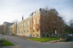
Jo Daviess County is a county located in the northwest corner of US state of Illinois. According to the 2010 census, it had a
population
of 22,678. Jo Daviess County was created on February
17, 1827.The county seat is Galena.
The county is named for Joseph Hamilton Daveiss
(1774-1811), commander of the Indiana Dragoons at the Battle of
Tippecanoe.
Jo Daviess County is part of the Tri-State Area and is located near Dubuque, Iowa and Platteville, Wisconsin. As part of the Driftless Area,
Jo Daviess County is known for its scenic stretches of road and valley views. Within Jo Daviess County lies Charles Mound, the highest natural
point in Illinois.
Etymology - Origin of Jo Daviess County Name
The county is named for Joseph Hamilton Daviess, prominent Kentucky lawyer and soldier; slain at the Battle of Tippecanoe in 1811.
Demographics:
County QuickFacts: CensusBureau Quick Facts
Jo Daviess County History
JoDaviess County was created on February 17, 1827 (Laws, 1827, p. 117) and was formed from Henry and Putnam Counties.
Present area, or parts of it, formerly included in: Putnam County (1825-1827), Henry County (1825-1827), Fulton County
(1823-1825), Pike County (1821-1823), Madison County (1812-1821) and St. Clair County (1801-1812).
The County was named for Joseph Hamilton Daviess, prominent lawyer of Kentucky, United States District Attorney, and
Major of the militia. He was killed at the battle of Tippecanoe in 1811. The County Seat is Galena (1827-Present).
Jo Daviess County was organized from Peoria, February 17, 1827, and was bounded as follows: Beginning on the Mississippi River at the northwestern corner of the state, thence down the Mississippi to the north line of the Military Tract, thence east to the Illinois River, thence north to the northern boundary of the state, thence west to the place of beginning. Galena was named as the county seat. Among those who have been prominent in the history of this county, who arrived in 1827, are, Dr. Horatio Newhall, Capt. H. H. Gear and family, John G. Hughlett, James G. Soulard, William B. Green, Harvey Mann, Charles Peck, Solomon Oliver, Allan Tomlin, Gov. Thomas Ford, Col. James M.Strode, C.C.P. Hunt, Capt. John Atchison, Paul M. Gratiot, Nathaniel Morris, Moses Hallett, Lucius H. and Edward Langworthy, William Hempstead, D. B. Morehouse, and many others whose names are familiar in Jo Daviess county.
Geography: Land and Water
As reported by the Census Bureau, the county has a total area of 619 square miles (1,602 km2), of which, 601 square miles (1,557 km2) of it is land and 18 square miles (46 km2) of it (2.85%) is water.
Jo Daviess county is located in north Illinois. Apple River Canyon
State Park and part of the Upper Mississippi River National Wildlife and
Fish Refuge are located in this county.
Neighboring Counties
Bordering counties are as follows:
- North: Lafayette County, Wis.
- East: Stephenson County
- Southeast: Carroll County
- Southwest: Jackson County, Iowa
- West: Dubuque County, Iowa
- Northwest: Grant County, Wis.
Education


Click Image to Enlarge
