


Click Image to Enlarge
Illinois Counties
There are one hundred and two counties in Illinois. St. Clair County was the first county established in what is today Illinois. Most counties in Illinois were named after early American leaders, especially of the American Revolutionary War, as well as soldiers from the Battle of Tippecanoe and the War of 1812.Johnson County, Illinois
Johnson County Education, Geography, and History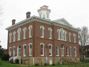
Johnson County is a county located in the state of Illinois. According to the 2010 census, it has a population of 12,582. Johnson County was created on September 14, 1812. The county seat is Vienna. The county is named for Richard Mentor Johnson, ninth Vice President of the United States and United States Senator from Kentucky.
Etymology - Origin of Johnson County Name
The county is named for Richard M. Johnson, a congressman from Kentucky. Johnson served in the Army in the War of 1812.
He later went on to be Vice President of the United States for one term, under President Martin Van Buren. He died
in 1850, shortly after winning re-election to the US House of Representatives.
Demographics:
County QuickFacts: CensusBureau Quick Facts
Johnson County History
Johnson County was created on September 14, 1812 (By proclamation, Territorial Record of Illinois, p. 26) and was
formed from Randolph County. Present area, or parts of it, formerly included in: Randolph County (1795-1812) and Knox,
Northwest Territory (1790-1801).
The County was named for Richard Mentor Johnson, a Colonel of the Kentucky militia, who served in Indian wars and the
War of 1812, and reputed to have killed the Indian chief, Tecumseh, at the battle of Thames. Johnson served as
Representative in Congress and United States Senator from Kentucky and Vice-President of the United States from 1837 to
1841. The County Seat is Vienna . Prior County Seats was Home of John Bradshaw (1813-1814), Elvira (1814-1818) and
Vienna (1818-Present).
Geography: Land and Water
As reported by the Census Bureau, the county has a total area of 349 square miles (904 km2), of which, 345 square miles (893 km2) of it is land and 4 square miles (11 km2) of it (1.22%) is water.
Johnson county is located in south Illinois. Cache River State
Natural Area is located in this county and part of Cypress Creek
National Wildlife Refuge and Shawnee National Forest.
Neighboring Counties
Bordering counties are as follows:
- North: Williamson County
- Northeast: Saline County
- East: Pope County
- Southeast: Massac County
- Southwest: Pulaski County
- West: Union County
Education


Click Image to Enlarge
