


Click Image to Enlarge
Illinois Counties
There are one hundred and two counties in Illinois. St. Clair County was the first county established in what is today Illinois. Most counties in Illinois were named after early American leaders, especially of the American Revolutionary War, as well as soldiers from the Battle of Tippecanoe and the War of 1812.Marshall County, Illinois
Marshall County Education, Geography, and History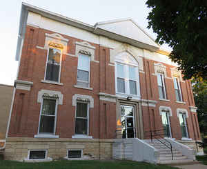
Marshall County is a county located in the state of Illinois. According to the 2010 census, it had a
population of 12,640. Marshall County was
created on January 19, 1839. The county
seat is Lacon. The county is named for
John Marshall (1755-1835), fourth and longest-serving Chief Justice of
the United States.
Marshall County is part of the Peoria, IL Metropolitan Statistical Area.
Etymology - Origin of Marshall County Name
The county is named for John Marshall, fourth Chief Justice of the US Supreme Court. Known for developing the power of the Supreme Court and formulating constitutional law. He wrote opinion in Marbury v. Madison establishing the principle of judicial review.
Demographics:
County QuickFacts: CensusBureau Quick Facts
Marshall County History
Marshall County was created on January 19, 1839 (Laws, 1839, p. 43) and was formed from Putnam and La Salle Counties.
Present area), or parts of it), formerly included in: Putnam County (1825-1839), Peoria County (1827-1827), Fulton
County (1823-1825), Sangamon County (1821-1823), Bond County (1817-1821), Madison County (1812-1821), St. Clair County
(1801-1812) and Knox), Northwest Territory (1795-1801).
The County was named for John Marshall, a soldier of the Revolution, statesman, author and jurist, Ambassador to France,
Representative in Congress from Virginia, Secretary of State and Chief Justice of the United States Supreme Court. The
County Seat is Lacon (1839-Present).
The History of Bureau County (Taken From the Earliest Historical Facts of Marshall-Putnam Counties, Also Bureau and Stark Counties,
Compiled and Published by Mr. Henry A. Ford, 1860)
Chapter II: The History of Illinois 1690-1825 and Chapter V: The Black Hawk War
Chapter I: European Discovery in the West
Geography: Land and Water
As reported by the Census Bureau, the county has a total area of 399 square miles (1,032 km2), of which, 386 square miles (1,000 km2) of it is land and 12 square miles (32 km2) of it (3.12%) is water.
Marshall county is located close to the center of Illinois. Marshall
State Fish & Wildlife Area and part of Chautauqua National Wildlife
Refuge is located in this county.
Neighboring Counties
Bordering counties are as follows:
- Northeast: Putnam County; La Salle County
- Southeast: Woodford County
- Southwest: Peoria County
- West: Stark County
- Northwest: Bureau County
Education


Click Image to Enlarge
