


Click Image to Enlarge
Illinois Counties
There are one hundred and two counties in Illinois. St. Clair County was the first county established in what is today Illinois. Most counties in Illinois were named after early American leaders, especially of the American Revolutionary War, as well as soldiers from the Battle of Tippecanoe and the War of 1812.Mason County, Illinois
Mason County Education, Geography, and History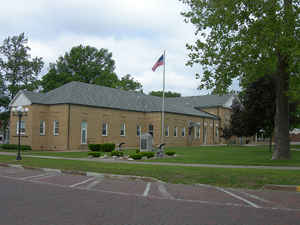
Mason County is a county located in the state of Illinois. According to the 2010 census, it had a population of 14,666. Mason County was created on January 20, 1841. The county seat is Havana. The county is named for George Mason, a member of the Virginia legislature who campaigned for the adoption of the United States Bill of Rights.
Etymology - Origin of Mason County Name
The county is named for George Mason, a member of the Virginia legislature who campaigned for the adoption of the United States Bill of Rights.
Demographics:
County QuickFacts: CensusBureau Quick Facts
Mason County History
Mason County was created on January 20, 1841 (Laws, 1841, p. 69) and was formed from Menard and Tazewell Counties.
Present area), or parts of it), formerly included in: Tazewell County (1827-1841), Peoria County (1825-1827), Sangamon
County (1821-1839), Menard County (1839-1841), Madison County (1812-1821) and St. Clair County (1790-1812).
The County was named for Mason County in Kentucky through the influence of emigrants from that county, and hence for
George Mason, a member of the Virginia legislature who campaigned for the adoption of the United States Bill of Rights.
The County Seat is Havana . Prior County Seats was Havana (1841-1843), Bath (1843-1851) and Havana (1851-Present).
Geography: Land and Water
As reported by the Census Bureau, the county has a total area of 563 square miles (1,459 km2), of which, 539
square miles (1,396 km2) of it is land and 24 square miles (63 km2) of it (4.34%) is water.
Mason county is located close to the center of Illinois. The County is bounded on the south by the Sangamon River, and on the west by the Illinois River. These rivers join
at the southwest tip of the County. Sand Ridge State Forest is located in
Mason county.
The soil covering much of Mason County is very sandy. This was formed during the melting of the Wisconsin Glacier
about 10,000 years before present. Melted water from the glacier deposited large amounts of sand in a delta region near
at the junction of the Sangamon and Illinois Rivers.
Neighboring Counties
Bordering counties are as follows:
- Northeast: Tazewell County
- Southeast: Logan County; Menard County
- Southwest: Cass County
- West: Schuyler County
- Northwest: Fulton County
Education


Click Image to Enlarge
