


Click Image to Enlarge
Illinois Counties
There are one hundred and two counties in Illinois. St. Clair County was the first county established in what is today Illinois. Most counties in Illinois were named after early American leaders, especially of the American Revolutionary War, as well as soldiers from the Battle of Tippecanoe and the War of 1812.Perry County, Illinois
Perry County Education, Geography, and History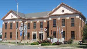
Perry County is a county located in the state of Illinois. According to the 2010 census, it had a population of 22,350. Perry County was created on January 29, 1827. The county seat is Pinckneyville. The county is named for Commodore Oliver Hazard Perry (1785-1819), American naval officer who led the victorious American forces at the Battle of Lake Erie.
Etymology - Origin of Perry County Name
The county is named for Commodore Oliver H. Perry, won distinction in the Battle of Lake Erie in 1813.
Demographics:
County QuickFacts: CensusBureau Quick Facts
Perry County History
Perry County was created on January 29, 1827 (Laws, 1827, p. 110) and was formed from Jackson and Randolph Counties.
Present area, or parts of it, formerly included in: Jackson County (1816-1827), Randolph County (1795-1827) and St.
Clair County (1790-1803).
The County was named for Oliver Hazard Perry, a Commodore of the United States Navy, who won distinction as Commander of
the fleet in the battle of Lake Erie, in 1813. The County Seat is Pinckneyville (1827-Present)-Not officially approved
until June, 1828.
Geography: Land and Water
As reported by the U.S. Census Bureau, the county has a total area of 447 square miles (1,160 km2), of which 442 square miles (1,140 km2) is land and 5.2 square miles (13 km2) (1.2%) is water.
Perry County is located in Southwestern Illinois. Pinckneyville, at the center of the county, is approximately 70 miles southeast of St. Louis, Missouri and 300 miles southwest of Chicago. The Mississippi River lies about 30 miles west of the County. Pyramid State Recreation Area is located in this county.
Neighboring Counties
Bordering counties are as follows:
- North: Washington County
- Northeast: Jefferson County
- Southeast: Franklin County
- South: Jackson County
- West: Randolph County
Education


Click Image to Enlarge
