


Click Image to Enlarge
Illinois Counties
There are one hundred and two counties in Illinois. St. Clair County was the first county established in what is today Illinois. Most counties in Illinois were named after early American leaders, especially of the American Revolutionary War, as well as soldiers from the Battle of Tippecanoe and the War of 1812.Putnam County, Illinois
Putnam County Education, Geography, and History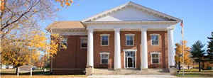
Putnam County is the least extensive county in the state of Illinois. According to the 2010 census, it had a
population of 6,006. Putnam County was created
on January 13, 1825. The county seat
is Hennepin. The county is named for General Israel
Putnam (1718-1790), commander of American forces at the Battle of Bunker
Hill.
Putnam County is part of the Ottawa-Peru, IL Micropolitan Statistical Area, which is also included in the Chicago-Naperville, IL-IN-WI
Combined Statistical Area.
Etymology - Origin of Putnam County Name
The county is named for General Israel Putnam, (1718-1790), commander of American forces at the Battle of Bunker Hill.
Demographics:
County QuickFacts: CensusBureau Quick Facts
Putnam County History
Putnam County was created on January 13, 1825 (Laws, 1825, p. 94) and was formed from unorganized land (Fulton
County). County organization was completed in 1831 (Laws, 1831, p. 54). Present area, or parts of it, formerly included
in: Fulton County (1823-1825), Pike County (1821-1823), Sangamon County (1821-1825), Bond County (1817-1821), Madison
County (1812-1821), St. Clair County (1801-1812) and Knox, Northwest Territory (1790-1801).
The County was named for Israel Putnam, who was a hero in the French and Indian War and a general in the American
Revolutionary War. The County Seat is Hennepin (1831-Present).
The History of Bureau County (Taken From the Earliest Historical Facts of Marshall-Putnam Counties, Also Bureau and Stark Counties,
Compiled and Published by Mr. Henry A. Ford, 1860)
Chapter II: The History of Illinois 1690-1825 and Chapter V: The Black Hawk War
Chapter I: European Discovery in the West
Geography: Land and Water
As reported by the Census Bureau, the county has a total area of 172 square miles (446 km2), making it the smallest county in Illinois. 160 square miles (414 km2) of the county is land and 12 square miles (32 km2) of it (7.23%) is water.
Putnam county is located in north Illinois. Donnelley/Depue State
Park is located in this county.
Neighboring Counties
Bordering counties are as follows:
- Northeast: La Salle County
- Southwest: Marshall County
- Northwest: Bureau County
Education


Click Image to Enlarge
