


Click Image to Enlarge
Illinois Counties
There are one hundred and two counties in Illinois. St. Clair County was the first county established in what is today Illinois. Most counties in Illinois were named after early American leaders, especially of the American Revolutionary War, as well as soldiers from the Battle of Tippecanoe and the War of 1812.Rock Island County, Illinois
Rock Island County Education, Geography, and History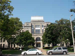
Rock Island County is a county located in the state of Illinois, bounded on the west by the Mississippi River. According to the 2010
census, it had a population of 147,546. Rock Island
County was created on February 9, 1831.The county
seat is Rock Island. The county is named
for rock island in the Mississippi River.
Rock Island County is one of the four counties that make up the Davenport-Moline-Rock Island, IA-IL Metropolitan Statistical Area.
Etymology - Origin of Rock Island County Name
The county is named for a rock island in the Mississippi River.
Demographics:
County QuickFacts: CensusBureau Quick Facts
Rock Island County History
Rock Island County was created on February 9, 1831 (Laws, 1831, p. 52) and was formed from Jo Daviess County. County
organization was completed in 1833. Present area, or parts of it, formerly included in: Attached to JoDaviess County
[Laws, 1831, p. 53] (1831-1833), JoDaviess County (1827-1831), Mercer County (1825-1827), Henry County (1825-1827), Pike
County (1821-1825), Fulton County (1823-1825), Madison County (1812-1821) and St. Clair County (1794-1812).
The County was named for rock island of that name in the Mississippi. The County Seat is Rock Island . Prior County
Seats was Farnhamsburg- House of John Barrell [temporary designation] (1833-1835), Stephenson- Name changed to Rock Island
in 1841 (1835-1841) and Rock Island (1841-Present).
Geography: Land and Water
As reported by the Census Bureau, the county has a total area of 451 square miles (1,168 km2), of which, 427 square miles (1,105 km2) of it is land and 24 square miles (63 km2) of it (5.41%) is water.
Rock Island county is located in northwest Illinois. Part of the
Upper Mississippi River National Wildlife and Fish Refuge is located in
this county.
Neighboring Counties
Bordering counties are as follows:
- North: Scott County, Iowa; Clinton County, Iowa
- Northeast: Whiteside County
- Southeast: Henry County
- Southwest: Mercer County; Louisa County, Iowa
- West: Muscatine County, Iowa
Education


Click Image to Enlarge
