


Click Image to Enlarge
Illinois Counties
There are one hundred and two counties in Illinois. St. Clair County was the first county established in what is today Illinois. Most counties in Illinois were named after early American leaders, especially of the American Revolutionary War, as well as soldiers from the Battle of Tippecanoe and the War of 1812.Tazewell County, Illinois
Tazewell County Education, Geography, and History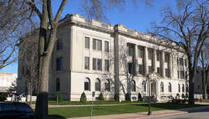
Tazewell County is a county located
in the state of Illinois. According to the 2010 census, it had a
population of 135,394. Tazewell County was created
on January 31, 1827. The county seat
and largest city is Pekin. The county is named for
Littleton Waller Tazewell (1774-1860), United States Senator from (and
later governor of) Virginia.
Tazewell County is part of the Peoria, IL Metropolitan Statistical Area. The majority of the population live along the western border of the
county.
Etymology - Origin of Tazewell County Name
The county is named for Littleton W. Tazewell, United States Senator from Virginia.
Demographics:
County QuickFacts: CensusBureau Quick Facts
Tazewell County History
Tazewell County was created on January 31, 1827 (Laws, 1827, p. 113) and was formed from unorganized land (Peoria
County ) and Fayette County. Present area, or parts of it, formerly included in: Peoria County (1825-1827), Sangamon
County (1821-1825), Bond County (1817-1821), Madison County (1812-1821), St. Clair County (1790-1812) and Knox,
Northwest Territory (1790-1801).
The County was named for Littleton Waller Tazewell, an eminent lawyer, Governor, Representative in Congress, and United
States Senator from Virginia. The County Seat is Pekin . Prior County Seats was Mackinaw (1827-1831), Pekin (1831-1836),
Tremont (1836-1849) and Pekin (1850-Present).
Geography: Land and Water
As reported by the Census Bureau, the county has a total area of 658 square miles (1,704 km2), of which, 649 square miles (1,681 km2) of it is land and 9 square miles (23 km2) of it (1.37%) is water.
Tazewell county is located close to the center of Illinois. Spring
Lake Fish and Wildlife Area is located in this county.
Neighboring Counties
Bordering counties are as follows:
- Northeast: Woodford County
- East: McLean County
- Southeast: Logan County
- Southwest: Mason County
- West: Fulton County
- Northwest: Peoria County
Education


Click Image to Enlarge
