


Click Image to Enlarge
Illinois Counties
There are one hundred and two counties in Illinois. St. Clair County was the first county established in what is today Illinois. Most counties in Illinois were named after early American leaders, especially of the American Revolutionary War, as well as soldiers from the Battle of Tippecanoe and the War of 1812.Vermilion County, Illinois
Vermilion County Education, Geography, and History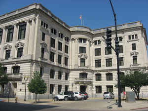
Vermilion County is a county
located in the eastern part of the state of Illinois, between the
Indiana border and Champaign County. According to the 2010 census, it had a
population of 81,625. Vermilion County was
created on January 18, 1826. The county
seat is located in Danville. The county is
named for the Vermilion River.
Vermilion County is part of the Danville, Illinois, Metropolitan Statistical Area.
Etymology - Origin of Vermilion County Name
The county is named for the Vermilion River.
Demographics:
County QuickFacts: CensusBureau Quick Facts
Vermilion County History
Vermilion County was created on January 18, 1826 (Laws, 1826, p. 50) and was formed from unorganized land (Edgar
County). Present area, or parts of it, formerly included in: Edgar County (1823-1826), Clark County (1819-1823),
Crawford County (1816-1819), Edwards County (1815-1816), Madison County (1812-1815), St. Clair County (1801-1812) and
Knox, Northwest Territory (1790-1803).
The County was named for the Vermilion River, the principal branches of which flow through the county. Prior County Seats was Courts held at the home of James Butler and Asa Elliott [temporary
designation](1826-1827) and Danville (1827-Present).
Vermilion county contains 21 incorporated settlements; the county seat and largest city is Danville. The county is
also divided into 19 townships which provide local services.
Geography: Land and Water
As reported by the Census Bureau, the county has a total area of 902 square miles (2,337 km2), of which 899 square miles (2,329 km2) is land and 3 square miles (8 km2) or 0.34% is water.
Vermilion county is located in east Illinois. Middle Fork State Fish
and Wildlife Area is located in this county.
Neighboring Counties
Bordering counties are as follows:
- North: Iroquois County
- Northeast: Benton County, Ind.; Warren County, Ind.
- Southeast: Vermillion County, Ind.
- South: Edgar County
- Southwest: Douglas County
- West: Champaign County
- Northwest: Ford County
Education
There are 15 school districts in the county that provide primary and secondary education. There are two post-secondary educational institutions: Danville Area Community College, a public two-year community college, and Lakeview College of Nursing, a four-year private institution (both located in Danville).


Click Image to Enlarge
