


Click Image to Enlarge
Missouri Counties
Missouri has one hundred and fourteen counties and one independent city. St. Louis City is separate from St. Louis County and is referred to as a "city not within a county." Following the Louisiana Purchase and the admittance of Louisiana into the United States in 1812, five counties were formed out of the Missouri Territory at the first general assembly. Most subsequent counties were apportioned from these five original counties.Adair County, Missouri
Adair County Education, Geography, and History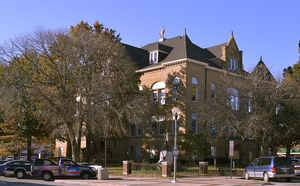
Adair County is a county located in the northeastern part of the state of Missouri. As of the 2010 US Census, the population was
25,607. Its county seat is Kirksville. The county was organized January 29, 1841 and named for Governor John Adair of Kentucky.
Adair County comprises the Kirksville, MO Micropolitan Statistical Area.
Etymology - Origin of Adair County Name
Named for John Adair, governor of Kentucky.
Demographics:
County QuickFacts: CensusBureau Quick Facts
History of Adair County, Missouri
"Adair County was organized January 29, 1841 and was named for Adair County, Kentucky, whence some of the early settlers came." The county in Kentucky was named for General John Adair of Mercer County, Kentucky, who served as governor of that state. (Violette, p. 40; Gannett, p. 16; Eaton, p. 201; RECORD OF CHARITON COUNTY, Part I, p. 11)
Source: Adams, Orvyl Guy. "Place Names In The North Central Counties Of Missouri." M.A. thesis., University of Missouri-Columbia, 1928
The first permanent settlement in Adair County began in 1828. Many of the first settlers were from Kentucky, and Adair County was named for John Adair, a respected Governor of Kentucky. This was 25 years after the Louisiana Purchase, seven years after Missouri was granted statehood, and four years after the Sac and Fox Native American tribes surrendered their claims to the land. The original settlement was called "Cabins of White Folks," or simply, "The Cabins," and was located six miles (10 km) west of present-day Kirksville along the Chariton River.
Geography: Land and Water
As reported by the Census Bureau, the county has a total area of 569 square miles (1,470 km2), of which 567 square miles (1,470 km2) is land and 2.1 square miles (5.4 km2) (0.4%) is water.
Neighboring Counties
Bordering counties are as follows:
- Putnam County (northwest)
- Schuyler County (north)
- Scotland County (northeast)
- Knox County (east)
- Macon County (south)
- Linn County (southwest)
- Sullivan County (west)
Education
Public schools
Adair County R-I School District - Novinger
Adair County R-II School District - Brashear
Kirksville R-III School District - Kirksville
La Plata R-2 School District - La Plata
Post-secondary education
A.T. Still University - Kirksville - (Kirksville College of Osteopathic Medicine) - Satellite Campus
Truman State University - Kirksville - A public, four-year university.
Moberly Area Community College - Kirksville - A satellite campus of the main community college campus in Moberly


Click Image to Enlarge
