


Click Image to Enlarge
Missouri Counties
Missouri has one hundred and fourteen counties and one independent city. St. Louis City is separate from St. Louis County and is referred to as a "city not within a county." Following the Louisiana Purchase and the admittance of Louisiana into the United States in 1812, five counties were formed out of the Missouri Territory at the first general assembly. Most subsequent counties were apportioned from these five original counties.Cape Girardeau County, Missouri
Cape Girardeau County Education, Geography, and History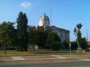
Cape Girardeau County is a county located in the southeastern part of the state of Missouri; its eastern border is formed by the
Mississippi River. As of the 2010 US Census, the population was 75,674. The county seat is Jackson, the first city in the US to be named in
honor of President Andrew Jackson. Officially organized on October 1, 1812, the county is named after Ensign Sieur Jean Baptiste de Giradot,
an official of the French colonial years. The "cape" in the county's name is named after a former promontory rock overlooking the Mississippi
River; this feature was demolished during railroad construction.
Cape Girardeau County is the central hub of the Cape Girardeau-Jackson, MO-IL Metropolitan Statistical Area. Its largest city is Cape
Girardeau.
Etymology - Origin of Cape Girardeau County Name
Named for Sieur de Girardot, a French officer.
Demographics:
County QuickFacts: CensusBureau Quick Facts
History of Cape Girardeau County
Bounded on the north by Perry County, on the west by Bollinger County, on the south by Stoddard County, and on the east by the Mississippi River. Cape Girardeau County had its origin in the Spanish District of Cabo Girardeau, which was established about the year 1793 when Don Louis Lorimer was authorized by Governor Carondelet to "establish himself and his Indians on any unoccupied territory on the western bank of the Mississippi River from the Missouri to Arkansas." He located at Cape Girardeau (q.v.) and was made commandant during the Genet agitation 1792-1795. The boundaries of the district were on the northern Apple Creek, and on the southern Tywappity Bottom. The southern boundary between Cape Girardeau and New Madrid remained in dispute until 1801 when General Anthony Soulard was ordered by Spanish authorities to fix the line five leagues below the city of Cape Girardeau (near the present town of Commerce in Scott County) from the Mississippi River to the St. Francois River. The County was organized from the district on October 1, 1812 as one of the five original counties and retained the original district boundaries until 1818, when Wayne County was cut off and Lawrence and Madison Counties were erected from Ste. Genevieve and Cape Girardeau Counties. Further boundary changes occurred in 1851 when Bollinger County was erected from Wayne, Stoddard, and Cape Girardeau Counties. (Violette 77-89, 46-7, Douglas I 67-9, Houck II 154, 167, Spanish Regime I XXII)
Source: Hamlett, Mayme L. "Place Names Of Six Southeast Counties Of Missouri." M.A. thesis., University of Missouri-Columbia, 1938.
Geography: Land and Water
As reported by the Census Bureau, the county has a total area of 586 square miles (1,520 km2), of which 579 square miles (1,500 km2) is
land and 7.8 square miles (20 km2) (1.3%) is water.
The geography of Cape Girardeau County varies greatly. The areas around the towns of Delta and Dutchtown are flood plains, which were
cultivated as cotton plantations. Western and northern areas are hilly and forested.
Neighboring Counties
Bordering counties are as follows:
- Perry County (northwest)
- Union County, Illinois (northeast across the river)
- Alexander County, Illinois (east across the Mississippi River)
- Scott County (southeast)
- Stoddard County (south)
- Bollinger County (west)
Education
Education
Of adults 25 years of age and older in Cape Girardeau County, 81.1% possess a high school diploma or higher while 24.2% hold a bachelor's
degree as their highest educational attainment.
Public schools
Delta R-V School District - Delta
Oak Ridge R-VI School District - Oak Ridge
Nell Holcomb R-IV School District - Egypt Mills
Cape Girardeau Career & Technology Center (10-12)
Private schools
Cape Christian School (K-8) - Cape Girardeau; Assembly of God/Pentecostal
Deer Creek Christian Academy (PK-7) - Cape Girardeau; Christian
St. Mary Cathedral School (K-8) - Cape Girardeau; Roman Catholic
St. Vincent De Paul Elementary School (K-8) - Cape Girardeau; Roman Catholic
Trinity Lutheran School (PK-8) - Cape Girardeau; Lutheran
Immaculate Conception School (PK-8) - Jackson; Roman Catholic
St. Paul Lutheran School (PK-8) - Jackson; Lutheran
Eagle Ridge Christian School (PK-12) - Cape Girardeau; Non-denominational Christian
Notre Dame Regional High School (9-12) - Cape Girardeau; Roman Catholic
Saxony Lutheran High School (9-12) - Jackson/Fruitland; Lutheran
Post-secondary education
Metro Business College - Cape Girardeau
Southeast Missouri State University - Cape Girardeau


Click Image to Enlarge
