


Click Image to Enlarge
Missouri Counties
Missouri has one hundred and fourteen counties and one independent city. St. Louis City is separate from St. Louis County and is referred to as a "city not within a county." Following the Louisiana Purchase and the admittance of Louisiana into the United States in 1812, five counties were formed out of the Missouri Territory at the first general assembly. Most subsequent counties were apportioned from these five original counties.Clinton County, Missouri
Clinton County Education, Geography, and History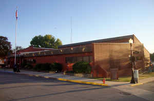
Clinton County is a county located in the state of Missouri. Based on the 2010 census, the county had a population of 20,743. Its county
seat is Plattsburg. The county was organized January 2, 1833 and named for Governor DeWitt Clinton of New York. The county seat of Plattsburg
derives it name from a town of a similar name that is the county seat of Clinton County, New York, which was also named for the Governor.
Clinton County is part of the Kansas City, MO-KS Metropolitan Statistical Area.
Etymology - Origin of Clinton County Name
Named for DeWitt Clinton, governor of New York.
Demographics:
County QuickFacts: CensusBureau Quick Facts
History of Clinton County
A few people settled in Clinton County as early as 1828, but a permanent settlement did not properly begin until 1833. This county, like many others in Missouri, was named in honor of one of America's most famous men De Witt Clinton, Governor of New York and well known because of his carrying through the construction of the Erie Canal. Clinton died February 11, 1828. The county was organized from a part of Clay, in 1833. It was reduced to its present limits in 1841. (Eaton; Campbell, p. 161; HIST. OF HARRISON, 1921, p. 119; SESSION LAWS, 1832, p. 47)
Source: Ewing, Martha K. "Place Names In The Northwest Counties Of Missouri." M.A. thesis., University of Missouri-Columbia, 1929.
Geography: Land and Water
As reported by the Census Bureau, the county has a total area of 423 square miles (1,100 km2), of which 419 square miles (1,090 km2) is
land and 4.5 square miles (12 km2) (1.1%) is water
Neighboring Counties
Bordering counties are as follows:
- DeKalb County (north)
- Caldwell County (east)
- Ray County (southeast)
- Clay County (south)
- Platte County (southwest)
- Buchanan County (west)
Education
Public schools
Cameron R-I School District - Cameron
Clinton County R-III School District - Plattsburg
East Buchanan County C-1 School District - Gower
Lathrop R-II School District - Lathrop


Click Image to Enlarge
