


Click Image to Enlarge
Missouri Counties
Missouri has one hundred and fourteen counties and one independent city. St. Louis City is separate from St. Louis County and is referred to as a "city not within a county." Following the Louisiana Purchase and the admittance of Louisiana into the United States in 1812, five counties were formed out of the Missouri Territory at the first general assembly. Most subsequent counties were apportioned from these five original counties.Crawford County, Missouri
Crawford County Education, Geography, and History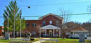
Crawford County is a county located in the state of Missouri. Based on the 2010 census, the population was 24,696. Its county seat is
Steelville. The county was organized in 1829 and is named after US Senator William H. Crawford of Georgia.
The section of Sullivan which is located in Crawford County is included in the St. Louis, MO-IL Metropolitan Statistical Area.
Etymology - Origin of Crawford County Name
Named for William H. Crawford, Georgia senator.
Demographics:
County QuickFacts: CensusBureau Quick Facts
History of Crawford County
Organized January 23, 1829. In the east-central part of the state, it is bounded on the north by Gasconade and Franklin counties, on the east by Washington and Iron counties; on the south by Reynolds and Dent counties; and on the west by Dent, Phelps, and Gasconade counties. Named for William Harris Crawford (1772-1834) of Georgia, prominent leader of the Democratic party, which was overwhelmingly favored in this part of Missouri. Crawford was a Senator from Georgia (1807-1813), United States Minister to France (1813-1815), and entered the cabinet of President Madison as Secretary of War in 1815. The next year, 1816, he was transferred to Secretary of the Treasury, a position which he held for eleven years, under Madison and Monroe. In 1824 he was nominated as Democratic candidate for the presidency. There being no choice by the electors, the choice was thrown into the House of Representatives, which finally chose the Whig candidate John Quincy Adams. President Adams invited Crawford to continue as Secretary of the Treasury, but he declined, and shortly afterwards retired from public life. In the next election of 1828 the Democrats came back into power with the resounding defeat of Adams by Andrew Jackson. It was just at this hour of Democratic victory, in 1829, the first year of Jackson's administration, that the Missouri legislature chose to honor their former leader by naming the new county for Crawford. (HIST. S.E. MISSOURI (1888) 175)
Source: Zimmer, Gertrude M. "Place Names Of Five Southeast Counties Of Missouri." M.A. thesis., University of Missouri-Columbia, 1944.
Geography: Land and Water
As reported by the Census Bureau, the county has a total area of 744 square miles (1,930 km2), of which 743 square miles (1,920 km2) is
land and 1.2 square miles (3.1 km2) (0.2%) is water.
Neighboring Counties
Bordering counties are as follows:
- Franklin County (north)
- Washington County (east)
- Iron County (southeast)
- Dent County (south)
- Phelps County (west)
- Gasconade County (northwest)
Education
Public schools
Crawford County R-I School District - Bourbon
Crawford County R-II School District - Cuba
Steelville R-III School District - Steelville
Private schools
Meramec Valley Christian School - Sullivan - Baptist - (PK-12)
Holy Cross Catholic School - Cuba, Missouri - Catholic - (PK-8)


Click Image to Enlarge
