


Click Image to Enlarge
Missouri Counties
Missouri has one hundred and fourteen counties and one independent city. St. Louis City is separate from St. Louis County and is referred to as a "city not within a county." Following the Louisiana Purchase and the admittance of Louisiana into the United States in 1812, five counties were formed out of the Missouri Territory at the first general assembly. Most subsequent counties were apportioned from these five original counties.Dallas County, Missouri
Dallas County Education, Geography, and History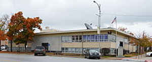
Dallas County is a county located in the state of Missouri. Based on the 2010 census, the population was 16,777. Its county seat is
Buffalo. The county was organized in 1842 as Niangua County and then renamed in 1844 for George M. Dallas, who served as Vice President under
James K. Polk.
Dallas County is part of the Springfield, MO Metropolitan Statistical Area.
Etymology - Origin of Dallas County Name
Originally organized as Niangua County in 1841; the name was changed to Dallas on December 16, 1844, due to the alleged difficulty in both spelling and pronouncing Niangua.
Demographics:
County QuickFacts: CensusBureau Quick Facts
History of Dallas County
Located in the west central part of the state; it is bounded on the north by Hickory and Camden Counties, on the east by Laclede County, on the south by Webster and Greene Counties, and on the west by Polk and Hickory Counties. This territory was first settled in 1831. It was organized as a county in 1841 under the name of Niangua, given because of the river that winds along its eastern border. In 1844, the name was changed, the reason assigned being that Niangua was "too hard to spell and pronounce." The adjoining county on the west had chosen (in 1835) the name Polk when James K. Polk was as yet only a Congressman; now that Polk had just been elected President (1844-1848), Niangua County followed it's neighbors example by adopting the name of the new Vice-President George Mifflin Dallas (1792-1864). Dallas had already had a distinguished career as Senator from Pennsylvania (1831-1833) and one of the national leaders of the Democratic party, the political faith favored by most citizens of the county. (HIST. DALLAS, pp. 507-508; Platbook; Campbell (1873)
Source: O'Brien, Anna. "Place Names Of Five Central Southern Counties of Missouri." M.A. thesis., University of Missouri-Columbia, 1939.
Geography: Land and Water
As reported by the Census Bureau, the county has a total area of 543 square miles (1,410 km2), of which 541 square miles (1,400 km2) is
land and 2.1 square miles (5.4 km2) (0.4%) is water
Neighboring Counties
Bordering counties are as follows:
- Camden County (north)
- Laclede County (east)
- Webster County (south)
- Greene County (southwest)
- Polk County (west)
- Hickory County (northwest)
Education
Public schools
Dallas County R-I School District - Buffalo
Hickory County R-I School District - Urbana


Click Image to Enlarge
