


Click Image to Enlarge
Missouri Counties
Missouri has one hundred and fourteen counties and one independent city. St. Louis City is separate from St. Louis County and is referred to as a "city not within a county." Following the Louisiana Purchase and the admittance of Louisiana into the United States in 1812, five counties were formed out of the Missouri Territory at the first general assembly. Most subsequent counties were apportioned from these five original counties.Holt County, Missouri
Holt County Education, Geography, and History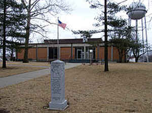
Holt County is a county located in the northwestern portion of the state of Missouri. Based on the 2010 census, the population was 4,912. Its county seat is Oregon. The county was organized February 15, 1841. Originally named Nodaway County, it was soon renamed for David Rice Holt (1803-1840), a Missouri state legislator from Platte County
Etymology - Origin of Holt County Name
Named for David Rice Holt, Missouri legislator from Platte County. Originally organized and named Nodaway County, the name was changed seventeen days later to honor the memory of D.R. Holt, who died during the legislative session.
Demographics:
County QuickFacts: CensusBureau Quick Facts
History of Holt County
Holt, a part of the Platte Purchase, was made a separate county in 1841. It was named in honor of Dr. David Rice Holt, a member of the State Legislature from Platte County, who died while a representative, December 7, 1840. "He was both a minister of the gospel and a physician, and had attained an enviable standing in each." (SESSION LAWS, 1840-1, p. 39; Eaton, p. 173; HIST. HOLT & ATCHISON, p. 100)
Source: Ewing, Martha K. "Place Names In The Northwest Counties Of Missouri." M.A. thesis., University of Missouri-Columbia, 1929.
Geography: Land and Water
As reported by the Census Bureau, the county has a total area of 470 square miles (1,200 km2), of which 463 square miles (1,200 km2) is
land and 7.7 square miles (20 km2) (1.6%) is water.
Neighboring Counties
Bordering counties are as follows:
- Atchison County (north)
- Nodaway County (northeast)
- Andrew County (southeast)
- Doniphan County, Kansas (south)
- Brown County, Kansas (southwest)
- Richardson County, Nebraska (west)
- Nemaha County, Nebraska (northwest)
Education
Public schools
Craig R-III School District - Craig
Mound City R-II School District - Mound City
South Holt County R-I School District - Oregon


Click Image to Enlarge
