


Click Image to Enlarge
Missouri Counties
Missouri has one hundred and fourteen counties and one independent city. St. Louis City is separate from St. Louis County and is referred to as a "city not within a county." Following the Louisiana Purchase and the admittance of Louisiana into the United States in 1812, five counties were formed out of the Missouri Territory at the first general assembly. Most subsequent counties were apportioned from these five original counties.Howell County, Missouri
Howell County Education, Geography, and History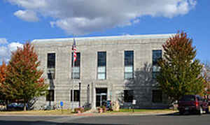
Howell County is a county located in the southern portion of the state of Missouri. Based on the 2010 census, the population was 40,400.
The largest city and county seat is West Plains. The county was officially organized on March 2, 1851, and is named after Josiah Howell, a
pioneer settler in the Howell Valley.
Howell County comprises the West Plains, MO Micropolitan Statistical Area.
Etymology - Origin of Howell County Name
Named for James Howell, pioneer settler. Some sources also state the county was named for Thomas J. Howell.
Demographics:
County QuickFacts: CensusBureau Quick Facts
History of Howell County
A very shallow, wide valley, drained by the upper part of Warm Fork Creek (earlier known as Howell Creek for the settlers there) in the center of which is West Plains. Josiah Howell, who bought the Adams Improvement (see Town Spring), considered the first permanent settler in the present limits of the county, and his sons Thomas Jefferson, later in the Legislature, and Wiley came from Tennessee in the early 1840s. (Mrs. A.C. Risley; S.J. Galloway; H. Chapin; R. Childers; Mrs. Fidelis Willis)
Source: Pottenger, Cora Ann. "Place Names Of Five Southern Border Counties Of Missouri." M.A. thesis., University of Missouri-Columbia, 1945.
Geography: Land and Water
As reported by the Census Bureau, the county has a total area of 928 square miles (2,400 km2), of which 927 square miles (2,400 km2) is
land and 1.1 square miles (2.8 km2) (0.1%) is water. It is the third-largest county in Missouri by land area and fourth-largest by total area.
Neighboring Counties
Bordering counties are as follows:
- Texas County (north)
- Shannon County (northeast)
- Oregon County (east)
- Fulton County, Arkansas (south)
- Ozark County (southwest)
- Douglas County (northwest)
Education
Of adults 25 years of age and older in Howell County, 73.4% possesses a high school diploma or higher while 10.9% holds a bachelor's degree or higher as their highest educational attainment.
Public schools
Mountain View-Birch Tree R-III School District - Mountain View
West Plains R-VII School District - West Plains
Willow Springs R-IV School District - Willow Springs
Fairview R-XI School District - West Plains
Glenwood R-VIII School District - West Plains
Howell Valley R-I School District - West Plains
Junction Hill C-12 School District - West Plains
Richards R-V School District - West Plains
Private schools
Faith Assembly Christian School - West Plains - (PK-12) - Assemblies of God/Pentecostal
Ozarks Christian Academy - West Plains - (K-10) - non denominational/Protestant - Classical Christian Education
Trinity Christian Academy - Mountain View - (K-12) - Pentecostal - Wade St., Mountain View.
Alternative and vocational schools
Ozark Horizon State School - West Plains - (K-12) - A school for handicapped students and those with other special needs.
South Central Career Center - West Plains - (09-12) - Vocational/technical
Colleges and universities
Missouri State University-West Plains - A satellite campus of Missouri State University


Click Image to Enlarge
