


Click Image to Enlarge
Missouri Counties
Missouri has one hundred and fourteen counties and one independent city. St. Louis City is separate from St. Louis County and is referred to as a "city not within a county." Following the Louisiana Purchase and the admittance of Louisiana into the United States in 1812, five counties were formed out of the Missouri Territory at the first general assembly. Most subsequent counties were apportioned from these five original counties.Jackson County, Missouri
Jackson County Education, Geography, and History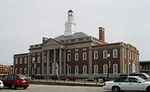
Jackson County is a county located in the western portion of the state of Missouri. Based on the 2010 census, the population was 674,158.
making it the second-most populous county in the state (after St. Louis County). Although Independence retains its status as the original
county seat, Kansas City serves as a second county seat and the center of county government. The county was organized December 15, 1826 and
named for President Andrew Jackson (elected 1828).
Jackson County is the central county of the Kansas City, MO-KS Metropolitan Statistical Area.
Etymology - Origin of Jackson County Name
Named for United States President Andrew Jackson.
Demographics:
County QuickFacts: CensusBureau Quick Facts
History of Jackson County
This county was organized in 1826 and named for Andrew Jackson (1767-1845). Conard states that most of the land in the western part was acquired directly from Indian tribes by a treaty signed June 2, 1825. The eastern part had been a part of Lillard County, the present Lafayette County. From 1827 to 1835 the territory of Jackson included that of Cass and Bates counties. Miss Johnson states in her thesis that Bates was organized and named in 1833, although for civil and military purposes it was attached to Jackson County until 1841. Cass County was separated from Jackson in 1835. Today the county is bounded on the north by Clay County and a part of Ray County, from which the two counties it is separated by the Missouri River. Lafayette County and a part of Johnson County bound it on the east, Cass County on the south, and Johnson and Wyandotte counties of Kansas, on the west. (LAWS OF MISSOURI 1826; HIST. JACKSON 1881, 66; Eaton; Conard Vol. 3, 403, 404; Thesis, 1833, 115, 131)
Source: Atchison, Anne. "Place Names Of Five West Central Counties Of Missouri." M.A. thesis., University of
Missouri-Columbia, 1937.
Kansas City
The largest city of this section and the second largest city in Missouri located in the northwestern section of the county. The present city may be said to date from a sale of lots in 1838. It bore first the name Town of Kansas. In 1853 the name was changed to City of Kansas and in 1889 changed to Kansas City. All three names were derived from the Kansas (Kaw) River (q.v.). In 1853 Hayward lists the post office as Kansas, and a map of 1855 gives the same name. (Map 1855; Hayward, 825; Deatherage 1927; Vol. I, 350; Hodge, Vol. I, 653; Eaton)
Source: Atchison, Anne. "Place Names Of Five West Central Counties Of Missouri." M.A. thesis., University of Missouri-Columbia, 1937.
Geography: Land and Water
As reported by the Census Bureau, the county has a total area of 616 square miles (1,600 km2), of which 604 square miles (1,560 km2) is
land and 12 square miles (31 km2) (1.9%) is water.
The Missouri River comprises Jackson County's northern border (with the exception of one small portion North of the river around the
intersection of highway 291 and highway 210 as well as all of the 291 bridge). The county has historically been a major traveling point for
American river travel.
Neighboring Counties
Bordering counties are as follows:
- Clay County (north)
- Ray County (northeast)
- Lafayette County (east)
- Johnson County (southeast)
- Cass County (south)
- Johnson County, Kansas (southwest)
- Wyandotte County, Kansas (northwest)
Education


Click Image to Enlarge
