


Click Image to Enlarge
Missouri Counties
Missouri has one hundred and fourteen counties and one independent city. St. Louis City is separate from St. Louis County and is referred to as a "city not within a county." Following the Louisiana Purchase and the admittance of Louisiana into the United States in 1812, five counties were formed out of the Missouri Territory at the first general assembly. Most subsequent counties were apportioned from these five original counties.Osage County, Missouri
Osage County Education, Geography, and History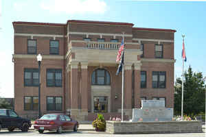
Osage County is a county located in the central portion of the state of Missouri. Based on the 2010 census, the population was 13,878.
Its county seat is Linn. The county was organized January 29, 1841, and named from the Osage River.
Osage County is part of the Jefferson City, MO Metropolitan Statistical Area.
Etymology - Origin of Osage County Name
Named for the Osage River. The name Osage is generally believed to be a corruption by the French of Washazhe, the name of the Osage Indians. The name has also been given as Wawsashe, Wacase, and Wassashsha. Marquette spelled the named Ouchage and Autrechacha. The name, to the Indians, meant "people."
Demographics:
County QuickFacts: CensusBureau Quick Facts
Osage County History
Osage County
Organized from Gasconade County by act of legislature January 29, 1841. It originally included part of Maries County. On the north is the Missouri River; on the south, Maries County; on the west, the Osage River and Miller County; on the east is Gasconade County. The county was named for the Osage River (q.v.), which forms most of its western boundary. (HIST. COLE etc., 593, 694)
Source: Weber, Frank. "Place Names Of Six South Central Counties of Missouri." M.A. thesis., University of Missouri-Columbia, 1938.
Geography: Land and Water
As reported by the Census Bureau, the county has a total area of 610 square miles (1,600 km2), of which 604 square miles (1,560 km2) is land and 6.1 square miles (16 km2) (1.0%) is water
Neighboring Counties
Bordering counties are as follows:
- Callaway County (north)
- Gasconade County (east)
- Maries County (south)
- Miller County (southwest)
- Cole County (west)
- Montgomery County (northeast)
Education
Public schools
Osage County R-I School District - Chamois
Osage County R-II School District - Linn
Osage County R-III School District - Westphalia
Private schools
St. Joseph Catholic School - Westphalia (K-09) - Roman Catholic
Immaculate Conception School - Loose Creek (K-09) - Roman Catholic
St. George School - Linn (K-09) - Roman Catholic
Sacred Heart School - Rich Fountain (K-09) - Roman Catholic
Holy Family School - Freeburg (K-09) - Roman Catholic
St. Mary' School - Bonnots Mill (K-09) - Roman Catholic
Post-secondary
Linn State Technical College - Linn


Click Image to Enlarge
