


Click Image to Enlarge
Missouri Counties
Missouri has one hundred and fourteen counties and one independent city. St. Louis City is separate from St. Louis County and is referred to as a "city not within a county." Following the Louisiana Purchase and the admittance of Louisiana into the United States in 1812, five counties were formed out of the Missouri Territory at the first general assembly. Most subsequent counties were apportioned from these five original counties.Pike County, Missouri
Pike County Education, Geography, and History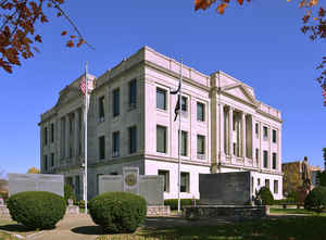
Pike County is a county located in the eastern portion of the state of Missouri. Based on the 2010 census, the population was 18,516. Its county seat is Bowling Green. The county was organized December 4, 1818, and named for explorer Zebulon M. Pike. The folksong Sweet Betsy from Pike is generally thought to refer to Pike County, Missouri.
Etymology - Origin of Pike County Name
Named for Zebulon Montgomery Pike, explorer.
Demographics:
County QuickFacts: CensusBureau Quick Facts
History of Pike County
One of four counties organized by an act of the territorial legislature on December 14, 1818, before Missouri became a state. At that time the legislature was meeting in St. Louis. Pike County was originally a part of St. Charles County; it extended west to Howard County, and north and northwest indefinitely. So extensive were its limits that it was frequently spoken of as the State of Pike. The boundaries were reduced in 1820, when Ralls County was formed, and again in 1836, when Audrain County was formed. On the north is Ralls County; on the east, the Mississippi River; on the south, Lincoln and Montgomery; on the west Audrain and Ralls. The county was named for Zebulon Montgomery Pike (1779-1813), whose two expeditions into the Louisiana Territory revealed much of interest about the new purchase. He was made a brigadier general during the War of 1812 and was killed by an explosion in the fort of York (Toronto) Canada. (HISTORY OF NORTHEAST MISSOURI, 508, TERRITORIAL ACTS 1818, 123- 131; J.D. Beauchamp)
Source: Leech, Esther. "Place Names Of Six East Central Counties Of Missouri." M.A. thesis., University of Missouri-Columbia, 1933.
Geography: Land and Water
As reported by the Census Bureau, the county has a total area of 685 square miles (1,770 km2), of which 670 square miles (1,700 km2) is
land and 14 square miles (36 km2) (2.1%) is water.
Neighboring Counties
Bordering counties are as follows:
- Ralls County (northwest)
- Pike County, Illinois (northeast)
- Calhoun County, Illinois (east)
- Lincoln County (south)
- Montgomery County (southwest)
- Audrain County (west)
Education
Public schools
Boncl R-X School District - Louisiana
Bowling Green R-I School District - Bowling Green
Louisiana R-II School District - Louisiana
Pike County R-III School District - Clarksville
Private schools
Pike County Christian School - Curryville (K-11) - Baptist
St. Clement School - Bowling Green (K-09) - Roman Catholic


Click Image to Enlarge
