


Click Image to Enlarge
Missouri Counties
Missouri has one hundred and fourteen counties and one independent city. St. Louis City is separate from St. Louis County and is referred to as a "city not within a county." Following the Louisiana Purchase and the admittance of Louisiana into the United States in 1812, five counties were formed out of the Missouri Territory at the first general assembly. Most subsequent counties were apportioned from these five original counties.Putnam County, Missouri
Putnam County Education, Geography, and History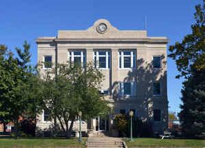
Putnam County is a county located in North Central Missouri. Based on the 2010 census, the population was 4,979. Its county seat is
Unionville. The county was organized February 28, 1845 and named for Israel Putnam, a hero in the French and Indian War and a general in the
American Revolutionary War.
Putnam County was established February 28, 1845 from parts of Adair and Sullivan counties. The following year a portion of Putnam was removed
to form of Dodge County. Both Putnam and Dodge extended nearly nine miles further north until a 18561 ruling by the Supreme Court on a border
dispute with Iowa assigned the contested land to Iowa. Both counties were left with less than the statutory minimum area for a county as set
by the state legislature, so Dodge County was dissolved and its area added to Putnam.
In its early years, the county seat changed frequently, often with contentious debate. Putnamville, Bryant Station (both no longer in
existence), and Hartford all served until a central location called Harmony, later renamed Unionville, was chosen
Etymology - Origin of Putnam County Name
Named for Israel Putnam, a Revolutionary War general.
Demographics:
County QuickFacts: CensusBureau Quick Facts
History of Putnam County
Putnam County was organized February 28, 1845 and was named for General Israel Putnam who was distinguished in the Revolutionary War. Putnam County was concerned with the dispute between Iowa and Missouri over a strip of territory nine miles wide which was claimed for both states. The dispute was settled in 1851 when the Supreme Court awarded this land to Iowa. In an act passed by the state legislature in 1853, Dodge and Putnam Counties were merged. (HIST. ADAIR, p. 555; Eaton, p. 343; Gannett, p. 225; Record of Char. Co., pp. 19-20)
Source: Adams, Orvyl Guy. "Place Names In The North Central Counties Of Missouri." M.A. thesis., University of Missouri-Columbia, 1928.
Geography: Land and Water
As reported by the Census Bureau, the county has a total area of 520 square miles (1,300 km2), of which 517 square miles (1,340 km2) is
land and 2.3 square miles (6.0 km2) (0.4%) is water
Neighboring Counties
Bordering counties are as follows:
- Wayne County, Iowa (northwest)
- Appanoose County, Iowa (northeast)
- Schuyler County (east)
- Adair County (southeast)
- Sullivan County (south)
- Mercer County (west)
Education
Public schools
Putnam County R-I School District - Unionville


Click Image to Enlarge
