


Click Image to Enlarge
Missouri Counties
Missouri has one hundred and fourteen counties and one independent city. St. Louis City is separate from St. Louis County and is referred to as a "city not within a county." Following the Louisiana Purchase and the admittance of Louisiana into the United States in 1812, five counties were formed out of the Missouri Territory at the first general assembly. Most subsequent counties were apportioned from these five original counties.Reynolds County, Missouri
Reynolds County Education, Geography, and History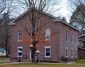
Reynolds County is a county located in the Ozark Foothills Region in the Lead Belt of Missouri. Based on the 2010 census, the population was
6,696. Its county seat is Centerville. The county was officially organized on February 25, 1845, and was named in honor of former Governor of
Missouri Thomas Reynolds
The county is home to Johnson's Shut-Ins State Park, a popular tourist attraction in the state of Missouri.
Etymology - Origin of Reynolds County Name
Named for Thomas Reynolds, governor of Missouri.
Demographics:
County QuickFacts: CensusBureau Quick Facts
History of Reynolds County
Organized February 25, 1845. Bounded by Dent, Iron, Carter, Shannon, and Wayne counties. Until 1830 the territory now embraced in Reynolds County was part of Ripley County. In 1830 it was attached to Washington, then to Shannon County, and in 1845 was organized as Reynolds County. It included part of present Iron County until 1857. The first settlement was made in 1812 by Henry Fry of Kentucky, who settled on the Middle Fork of Black River. In 1816 Major Henry located near the mouth of the three forks and later Seth Hyatt and James Logan settled on Logan's Creek. The commissioners appointed to locate the seat of justice selected Lesterville, but in 1867 the courthouse burned and the county seat was moved to Centerville. Five townships were organized before 1870: Black River, Carroll, Jackson, Logan, and Webb. Lesterville Township (q.v.) was cut off from Black River Township in 1872. The county was named in honor of Thomas Reynolds (1796-1844), of Howard County, Governor of Missouri from 1840-1844, who committed suicide while in office. Governor Reynolds is noted for writing the shortest act in the history of the Missouri Legislature: Imprisonment for debt is hereby abolished. His death occurred just the year before the county was organized. (Stevens II, Douglass I 179-311, Eaton, Conard)
Source: Hamlett, Mayme L. "Place Names Of Six Southeast Counties Of Missouri." M.A. thesis., University of Missouri-Columbia, 1938.
Geography: Land and Water
As reported by the Census Bureau, the county has a total area of 814 square miles (2,110 km2), of which 808 square miles (2,090 km2) is
land and 5.9 square miles (15 km2) (0.7%) is water.
Neighboring Counties
Bordering counties are as follows:
- Dent County (northwest)
- Iron County (northeast)
- Wayne County (southeast)
- Carter County (south)
- Shannon County (west)
Education
Of adults 25 years of age and older in Reynolds County, 65.2% possesses a high school diploma or higher while 7.5% holds a bachelor's degree or higher as their highest educational attainment.
Public schools
Bunker R-III School District - Bunker
Centerville R-I School District - Centerville
Lesterville R-IV School District - Lesterville
Southern Reynolds County R-II School District - Ellington


Click Image to Enlarge
