


Click Image to Enlarge
Missouri Counties
Missouri has one hundred and fourteen counties and one independent city. St. Louis City is separate from St. Louis County and is referred to as a "city not within a county." Following the Louisiana Purchase and the admittance of Louisiana into the United States in 1812, five counties were formed out of the Missouri Territory at the first general assembly. Most subsequent counties were apportioned from these five original counties.St. Clair County, Missouri
St. Clair County Education, Geography, and History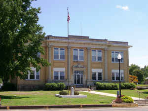
St. Clair County is a county located in the western portion of the state of Missouri. Based on the 2010 census, the population was 9,805. Its county seat is Osceola. The county was organized in 1841 and named for General Arthur St. Clair, Governor of the Northwest Territory. St. Clair was also the 9th President of the United States in Congress Assembled. Under his Presidency, the Northwest Ordinance and United States Constitution were passed
Etymology - Origin of St. Clair County Name
Named for Arthur St. Clair, a Revolutionary War general.
Demographics:
County QuickFacts: CensusBureau Quick Facts
History of Saint Clair County
In the southwest part of the state, bounded on the north by Henry County, on the east by Benton and Hickory Counties, on the west by Bates and Vernon Counties, and on the south by Cedar and Polk Counties. Organized February 15, 1841, and named in honor of General Arthur St. Clair (1734-1818), who was of revolutionary fame. He served under Wolfe at "Quebec and was the first Governor of the Northwest Territory in 1791. In 1845, the boundary line of St. Clair County was changed to the present boundary. The territory now included in St. Clair County was attached to Rives County, now Henry County, for civil and military purposes on February 11, 1835. On May 5, 1835, the whole of St. Clair County was made a township of Rives County under the name of St. Clair Township. On November 4, 1835 Rives County Court made a change, giving St. Clair two townships naming them Weaubleau and Monegaw. In 1840, a petition was drawn up for the organization of St. Clair County into an independent municipality. (Conard's Encyclopedia of Missouri (1901), V, 424; HIST. HENRY & ST. CLAIR (1883), 836, 853, 855, 856; International Encyclopedia (1926), XX, 336)
Source: Johnson, Bernice E. "Place Names In Six Of The West Central Counties Of Missouri." M.A. thesis., University of Missouri-Columbia, 1933.
Geography: Land and Water
As reported by the Census Bureau, the county has a total area of 702 square miles (1,820 km2), of which 670 square miles (1,700 km2) is
land and 32 square miles (83 km2) (4.6%) is water.
Neighboring Counties
Bordering counties are as follows:
- Henry County (north)
- Benton County (northeast)
- Hickory County (east)
- Polk County (southeast)
- Cedar County (south)
- Vernon County (southwest)
- Bates County (northwest)
Education
Public schools
Appleton City R-II School District - Appleton City
Hudson R-IX School District - Appleton City
Osceola Public Schools - Osceola
Roscoe C-1 School District - Roscoe
Lakeland R-III School District - Lowry City & Deepwater


Click Image to Enlarge
