


Click Image to Enlarge
Missouri Counties
Missouri has one hundred and fourteen counties and one independent city. St. Louis City is separate from St. Louis County and is referred to as a "city not within a county." Following the Louisiana Purchase and the admittance of Louisiana into the United States in 1812, five counties were formed out of the Missouri Territory at the first general assembly. Most subsequent counties were apportioned from these five original counties.St. Louis County, Missouri
St. Louis County Education, Geography, and History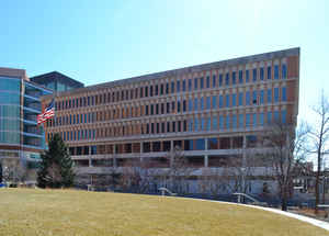
St. Louis County is a county located in the state of Missouri. As of the 2014 Census Bureau population estimate, the population was
1,001,876, making it the most populous county in Missouri. Its county seat is Clayton. The current county executive is Steve Stenger.
St. Louis County borders but does not include St. Louis, which is an independent city. It is included in the St. Louis, MO-IL Metropolitan
Statistical Area.
Etymology - Origin of St. Louis County Name
Named for St. Louis (King Louis IX of France), patron saint of King Louis XV.
Demographics:
County QuickFacts: CensusBureau Quick Facts
History of Saint Louis County
Organized October 1, 1812, as one of the five original counties; named for St. Louis (King Louis IX of France), patron saint of King Louis XV.
St. Louis County is a county located in the state of Missouri. According to the 2000 census, the population was 1,016,315, making the county the most populous in the state of Missouri. Its county seat is Clayton. St. Louis County is part of the sprawling St. Louis Metro Area wherein the independent City of St. Louis and its suburbs in St. Louis County, as well as the surrounding counties in both Missouri and Illinois all together account for a total population of nearly 3 million people. St. Louis County borders the City of St. Louis, which is independent from St. Louis County.
Geography: Land and Water
As reported by the Census Bureau, the county has a total area of 524 square miles (1,356 km2), of which, 508 square miles (1,315 km2) of it is land and 16 square miles (41 km2) of it (3.03%) is water. St. Louis County is part of the Greater St. Louis metropolitan area.
The Missouri River forms the northern border with Saint Charles County, exclusive of a few areas where the river
has changed its course. The Meramec River forms most of its southern border with Jefferson County. To the east is
the City of Saint Louis and the Mississippi River. The western boundary with Franklin County is the north-south line
where the distance between the Meramec and Missouri Rivers is the shortest, bisecting the City of Pacific roughly 2
blocks east of Hwy OO/F
Neighboring Counties
Bordering counties are as follows:
- St. Charles County (north, northwest)
- Madison County, Illinois (northeast)
- City of St. Louis (east)
- St. Clair County, Illinois & Monroe County, Illinois (southeast)
- Jefferson County (south)
- Franklin County (southwest)
Education
Education in St. Louis County is provided by 24 school districts, private schools, both a unified public library system and several municipal libraries, and several colleges and universities.
Public and non-profit private colleges and universities in St. Louis County include Concordia Seminary, Eden Theological Seminary, Fontbonne University, Kenrick-Glennon Seminary, Logan College of Chiropractic, Maryville University, Missouri Baptist University, University of Missouri-St. Louis, Saint Louis Christian College, three campuses of the St. Louis Community College, Washington University in St. Louis, and Webster University.


Click Image to Enlarge
