


Click Image to Enlarge
Missouri Counties
Missouri has one hundred and fourteen counties and one independent city. St. Louis City is separate from St. Louis County and is referred to as a "city not within a county." Following the Louisiana Purchase and the admittance of Louisiana into the United States in 1812, five counties were formed out of the Missouri Territory at the first general assembly. Most subsequent counties were apportioned from these five original counties.Stoddard County, Missouri
Stoddard County Education, Geography, and History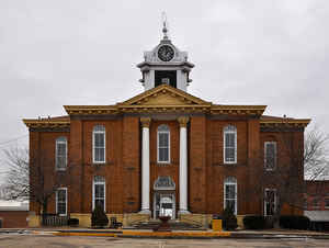
Stoddard County is a county located in the southeastern portion of the state of Missouri. Based on the 2010 census, the population was 29,968. The county seat is Bloomfield. The county was officially organized on January 2, 1835, and is named for Amos Stoddard, the first American Civil Commandant of Upper Louisiana
Etymology - Origin of Stoddard County Name
Named for Amos Stoddard, first American Civil Commandant of Upper Louisiana.
Demographics:
County QuickFacts: CensusBureau Quick Facts
History of Stoddard County
The general assembly passed an act in 1829 defining the boundaries of a new county to be erected out of parts of Wayne and New Madrid Counties. It was to be named in honor of Captain Amos Stoddard (1762-1813), agent of the United States government who received the transfer of the Louisian Territory from France. (March 10, 1804) At this time the county was attached to Cape Girardeau County, and the court of that county divided the territory into two townships. That part of the territory west of Castor River was called Pike Township, and the part northwest of Castor River was called Castor Township. It remained under the jurisdiction of Cape Girardeau County until 1835, when the legislature passed an act to organize the county government. The territory of the new county lay between the St. Francois and Little Rivers, and to the south of Mingo and Big Swamps. (Douglass I 304, M.H.R. 13:68, DICT. of AM. BIOG.)
Source: Hamlett, Mayme L. "Place Names Of Six Southeast Counties Of Missouri." M.A. thesis., University of Missouri-Columbia, 1938.
Geography: Land and Water
As reported by the Census Bureau, the county has a total area of 829 square miles (2,150 km2), of which 823 square miles (2,130 km2) is
land and 5.8 square miles (15 km2) (0.7%) is water
Neighboring Counties
Bordering counties are as follows:
- Bollinger County (north)
- Cape Girardeau County (northeast)
- Scott County (northeast)
- New Madrid County (southeast)
- Dunklin County (south)
- Butler County (southwest)
- Wayne County (northwest)
Education
Public schools
Advance R-IV School District - Advance
Bell City R-II School District - Bell City
Bernie R-XIII School District - Bernie
Bloomfield R-XIV School District - Bloomfield
Dexter R-XI School District - Dexter
Puxico R-VIII School District - Puxico
Richland R-I School District - Essex


Click Image to Enlarge
