


Click Image to Enlarge
Missouri Counties
Missouri has one hundred and fourteen counties and one independent city. St. Louis City is separate from St. Louis County and is referred to as a "city not within a county." Following the Louisiana Purchase and the admittance of Louisiana into the United States in 1812, five counties were formed out of the Missouri Territory at the first general assembly. Most subsequent counties were apportioned from these five original counties.Sullivan County, Missouri
Sullivan County Education, Geography, and History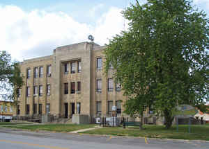
Sullivan County is a county located in the northern portion of the state of Missouri. Based on the 2010 census, the population was 6,714. Its county seat is Milan. The county was organized February 14, 1845 and named for Major General John Sullivan of the American Revolutionary War.
Etymology - Origin of Sullivan County Name
Named for James Sullivan, a Revolutionary War general.
Demographics:
County QuickFacts: CensusBureau Quick Facts
History of Sullivan County
Sullivan County was fully organized Febrary 16, 1843 and named by Hon. E.C. Morelock for his native county in Tennessee. In the preliminary organization the county had been named Highland. The county was named for General James Sullivan of Sullivan, Tennessee. General James Sullivan was a member of the Continental Congress of 1782. He died December 10, 1808. "The name Highland was dropped because it had originally been applied in derision of the pretensions of the early pioneers." HIST. ADAIR, p. 48; Eaton, p. 68; RECORD OF CHAR. COUNTY, pp. 21-2)
Source: Adams, Orvyl Guy. "Place Names In The North Central Counties Of Missouri." M.A. thesis., University of Missouri-Columbia, 1928.
Geography: Land and Water
As reported by the Census Bureau, the county has a total area of 652 square miles (1,690 km2), of which 648 square miles (1,680 km2) is
land and 3.5 square miles (9.1 km2) (0.5%) is water.
The main water courses in Sullivan County are Medicine, Locust, East Locust, Yellow, and Spring Creeks. The highest point in the county, about
1,060 feet (320 m) above sea level, is on the primary divide between the Chariton River and Grand River drainage basins along its northern
border shared with Putnam County northwest of Green City. The lowest point, about 740 feet (230 m) above sea level, is where Locust Creek
flows out of the county on its southern border with Linn County, near the town of Browning
Neighboring Counties
Bordering counties are as follows:
- Putnam County (north)
- Adair County (east)
- Linn County (south)
- Grundy County (southwest)
- Mercer County (northwest)
Education
Public schools
Green City R-I School District - Green City
Milan C-2 School District - Milan
Newton-Harris R-III School District - Newtown


Click Image to Enlarge
