


Click Image to Enlarge
Missouri Counties
Missouri has one hundred and fourteen counties and one independent city. St. Louis City is separate from St. Louis County and is referred to as a "city not within a county." Following the Louisiana Purchase and the admittance of Louisiana into the United States in 1812, five counties were formed out of the Missouri Territory at the first general assembly. Most subsequent counties were apportioned from these five original counties.Vernon County, Missouri
Vernon County Education, Geography, and History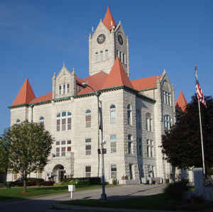
Vernon County is a county located in west central Missouri. Based on the 2010 census, the population was 21,159. Its county seat is Nevada. The county was organized on February 27, 1855 and was named for Col. Miles Vernon (1786-1867), a state senator and veteran of the Battle of New Orleans.
Etymology - Origin of Vernon County Name
Named for Miles Vernon, Missouri legislator.
Demographics:
County QuickFacts: CensusBureau Quick Facts
History of Vernon County
In the southwest part of Missouri, bordered on the north by Bates County, on the east by St. Clair and Cedar Counties, on the south by Barton County, and on the west by the state of Kansas. Organized in 1855, and named for Colonel Miles Vernon (1786-1866), who came from Laclede County to Vernon about 1840. He was a soldier in the War of 1812 under General Jackson at the Battle of New Orleans, was elected three times to the State Senate, and accompanied General Price's army into the Confederacy and remained in the South during the war. In 1825 Vernon County Territory was included in Jackson County except the lowest tier of Congressional Township, which belonged to Wayne, but came under the jurisdiction of Crawford County in 1829 and was attached to Greene County in 1833. In 1841, Bates County was organized and comprised all the territory both in Bates and Vernon. In 1851, an attempt was made to create two counties out of the the then limits of Bates and Cass. One of these new counties was to be called Vernon, and was to be composed of the territory now included in Bates except the southern two miles. The other proposed new county was to retain the name of Bates, and was to comprise all the territory now in Vernon. This attempt was declared unconstitutional, and was never put into operation. However, it is interesting to note that this arrangement appeared on Fisher's Map for 1857. Historically, of course, this is incorrect, but doubtless his information was gathered from the old law, and his map printed sometime before publication. In 1855, the present names and limits were adopted. (Johnson's HIST. VERNON (1911), I, 206; Holcombe's HIST. VERNON (1877), 196; Fisher's Map 1857)
Source: Johnson, Bernice E. "Place Names In Six Of The West Central Counties Of Missouri." M.A. thesis., University of Missouri-Columbia, 1933.
Geography: Land and Water
As reported by the Census Bureau, the county has a total area of 837 square miles (2,170 km2), of which 826 square miles (2,140 km2) is
land and 10 square miles (26 km2) (1.2%) is water
Neighboring Counties
Bordering counties are as follows:
- Bates County (north)
- St. Clair County (northeast)
- Cedar County (east)
- Barton County (south)
- Crawford County, Kansas (southwest)
- Bourbon County, Kansas (west)
- Linn County, Kansas (northwest)
Education
Public schools
Bronaugh R-VII School District - Bronaugh
Nevada R-V School District - Nevada
Northeast Vernon County R-I School District - Walker
Sheldon R-VIII School District - Sheldon
Private schools
Nevada Seventh-day Adventist Christian School - Nevada (02-07) - Seventh-day Adventist
St. Mary Elementary School - Nevada (PK-05) - Roman Catholic
Colleges and universities
Cottey College - Nevada A private, two-year community college for women.


Click Image to Enlarge
