


Click Image to Enlarge
Missouri Counties
Missouri has one hundred and fourteen counties and one independent city. St. Louis City is separate from St. Louis County and is referred to as a "city not within a county." Following the Louisiana Purchase and the admittance of Louisiana into the United States in 1812, five counties were formed out of the Missouri Territory at the first general assembly. Most subsequent counties were apportioned from these five original counties.Warren County, Missouri
Warren County Education, Geography, and History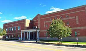
Warren County is a county located in the eastern portion of the state of Missouri. Based on the 2010 census, the population was 32,513.
The county is located on the north side of the Missouri River. Its county seat is Warrenton. The county was organized on January 5, 1833, and
named for General Joseph Warren, who died in the Battle of Bunker Hill during the American Revolutionary War.
Warren County is part of the St. Louis, MO-IL Metropolitan Statistical Area.
Etymology - Origin of Warren County Name
Named for Joseph Warren, a Revolutionary War general.
Demographics:
County QuickFacts: CensusBureau Quick Facts
History of Warren County
In the east-central part of Missouri, bounded on the north by Montgomery and Lincoln Counties, on the east by Lincoln, and St. Charles Counties, on the south by the Missouri River and on the west by Montgomery County. Named in honor of General Joseph Warren, who fell at the Battle of Bunker Hill, June 17, 1775. He was born at Roxbury, Massachusetts, June 11, 1741, and was graduated from Harvard College in 1759, and later studied medicine in Boston. He took part in a combat which destroyed a British ship of war off Chelsea Beach. He was one of the leaders who opposed the Stamp Act and drafted the Suffolk Resolves, which urged forcible opposition to Great Britain, if necessary, and pledged submission to the Continental Congress, which resolves were passed September 9, 1774. He was a member of the first three provincial congresses and president of the third. He was a volunteer at the Battles of Lexington and Bunker Hill. On June 14, 1775, he was commissioned an American major general, but three days later, and before his commission was made out, he fell mortally wounded. He was Grand-master of all Lodges of Free Masons in the United States at the time of his death. The first white settlement in Warren County was made by French trappers and traders at the village of Charrete about 1763. After the French colonists came David Bryan in 1800, 1801, or 1802, and settled on the Tuque, an elevated land about one and one-half miles southeast of Marthasville. Robert Ramsey, William Ramsey, and Thomss Kennedy came to the county about this time. Warren County was organized by a legislative act in 1833. It was carved out of Montgomery County. (Campbell, 625; Barns, 544; HIST. ST. CHARLES, 956; MONUMENT TO WARREN, 16-17; Conard VI, 337-8; Williams, STATE OF MISSOURI, 573; Eaton; Warren Centennial, 9)
Source: Harrison, Eugenia L. "Place Names Of Four River Counties In Eastern Missouri." M.A. thesis., University of Missouri-Columbia, 1943.
Geography: Land and Water
As reported by the Census Bureau, the county has a total area of 438 square miles (1,130 km2), of which 429 square miles (1,110 km2) is
land and 9.2 square miles (24 km2) (2.1%) is water.
Neighboring Counties
Bordering counties are as follows:
- Lincoln County (north)
- St. Charles County (east)
- Franklin County (south)
- Gasconade County (southwest)
- Montgomery County (west)
Education
Public schools
Warren County R-III School District - Warrenton
Wright City R-II School District - Wright City
Private schools
Holy Rosary School - Warrenton (K-08) - Roman Catholic
St. Vincent De Paul School - Marthasville (K-08) - Roman Catholic
St. Ignatius Loyola School - Marthasville (PK-08) - Roman Catholic


Click Image to Enlarge
