

Click Image to Enlarge
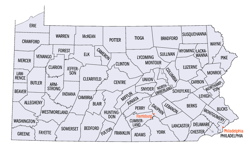
Pennsylvania Counties
There are sixty-seven counties of the Commonwealth of Pennsylvania in the United States of America. The city of Philadelphia is coterminous with Philadelphia County, and governmental functions have been consolidated since 1854.McKean County, Pennsylvania
McKean County Education, Geography, and History
McKean County is a rural county located in the state of Pennsylvania. Based on the 2010 census, the population was 43,450. Its county seat
is Smethport. The county was created in 1804 and later organized in 1826. It was named in honor of former Pennsylvania Governor and
Declaration of Independence signer Thomas McKean.
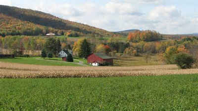
McKean County comprises the Bradford, PA Micropolitan Statistical Area. It is located in a sparsely populated region known as the
"Pennsylvania Wilds", including the Allegheny National Forest and borders New York.
Etymology - Origin of McKean County Name
Named for Governor Thomas McKean.
Demographics:
County QuickFacts: CensusBureau Quick Facts
McKean County History
Created on March 26, 1804 from part
of Lycoming County and named for Governor Thomas McKean. It was attached to
Centre County until 1814, when it was combined with Potter County to elect
commissioners jointly, and was also attached to Lycoming County for judicial and
election purposes. It was formally organized in 1826. Smethport, the county
seat, was laid out in 1807, and named in honor of Raymond and Theodore de Smeth,
Amsterdam bankers. It was incorporated as a borough on February 11, 1853.
Although Indian leaders yielded the land at the second Treaty of Fort Stanwix,
the "Last Purchase" (1784), distance and dense forest delayed settlement. After
1798 settlers from New York arrived, many originally from New England. Except
for Sergeant Township, all early settlements were on the Allegheny River and its
tributaries. Lumbering controlled the economy and settlement spread with each
new cutting operation. Bradford grew from a lumber camp. Deep drilling brought
an oil boom in 1871, lasting two decades, and the water injection method revived
production for another boom, 1930 to 1950. Railroads arrived in the late 1860s
to revive the lumber industry, and tanning and wood chemical industries
(turpentine, creosote, etc.) flourished while the forests lasted. But by 1925
little timber remained. The Civil War leader Thomas Leiper Kane did much to
develop the area. The county led the nation in natural gas production from 1895
to 1905. A lumber industry revived after World War II using managed forest
systems, and there is a little crude oil production. Other products today
include motor oil, Zippo Lighters, electronics, corrugated boxes, furniture,
glass containers and construction blocks, and oil and gas pipes and equipment.
The county's success is attested to by the value added to the economy from its
manufactures, which increased 66 percent between 1987 and 1992. Commercial
forest lands and the National Forest cover much of the county; only 7 percent of
the area is farmed.
Geography: Land and Water
As reported by the Census Bureau, the county has a total area of 984 square miles (2,549 km2), of which, 982
square miles (2,542 km2) of it is land and 3 square miles (7 km2) of it (0.26%) is water.
Neighboring Counties
Bordering counties are as follows:
- Cattaraugus County, New York (north)
- Allegany County, New York (northeast)
- Potter County (east)
- Cameron County (southeast)
- Elk County (south)
- Forest County (southwest)
- Warren County (west)
Education
Public school districts
Bradford Area School District
Kane Area School District (Also covers part of Elk County)
Otto-Eldred School District
Port Allegany School District (Also covers part of Potter County)
Smethport Area School District
Oswayo Valley School District (Also covers part of Potter County)


Click Image to Enlarge
