

Click Image to Enlarge
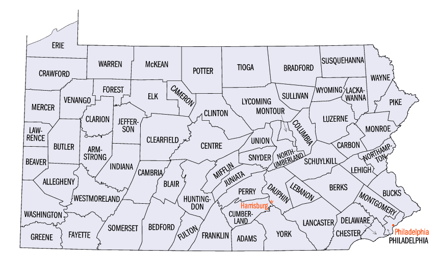
Pennsylvania Counties
There are sixty-seven counties of the Commonwealth of Pennsylvania in the United States of America. The city of Philadelphia is coterminous with Philadelphia County, and governmental functions have been consolidated since 1854.Mercer County, Pennsylvania
Mercer County Education, Geography, and History
Mercer County is a county located in the state of Pennsylvania. Based on the 2010 census, the population was 116,638. Its county seat is
Mercer, and its largest city is Hermitage. The county was created in 1800 and later organized in 1803.
Mercer County is included in the Youngstown-Warren-Boardman, OH-PA Metropolitan Statistical Area.
Etymology - Origin of Mercer County Name
Named for General Hugh Mercer.
Demographics:
County QuickFacts: CensusBureau Quick Facts
Mercer County History
It was created on March 12, 1800,
from part of Allegheny County and named for General Hugh Mercer. It was attached
to Crawford County until February 1804 when it was formally organized. Mercer,
the county seat, was laid out in 1803 and incorporated as a borough on March 28,
1814.
Included in the Last Purchase of 1784, the land that became this county was
intended to be Donation Land awarded to compensate Revolutionary veteran
soldiers. Settlers slowly arrived in the 1790s, but the county was created
before there was much population. The towns of Mercer (at first a tavern),
Sharon, Greenville, and Grove City, all began between 1796 and 1798.
Distilleries and grist and sawmills marked the early economy. A canal to the
Allegheny River opened in 1834, and one to Erie in 1844. These stimulated coal
and iron mining. The low quality iron ore soon was abandoned, but Mercer's
famous block coal sold well. Railroads began to arrive in 1864. Using the block
coal, blast furnaces began in 1838, and the Sharon Iron Company began a rolling
mill and foundry in 1851. Iron rails, nails, and bars were the main products
until the industry was jolted by the Panic of 1873. The first steel mill opened
in 1887; the Sharon Steel works in 1896. After World War II, the Army's Camp
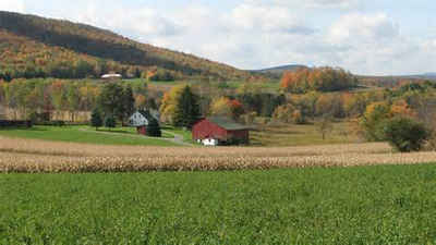
Reynolds was turned into an industrial park. Pymatuning Dam in 1934 and Shenango
Dam in 1967 rearranged the county's topography. Sheep and dairy farming persist,
some on it on Amish farms. Farms cover 42 percent of the county, and oats and
sheep are produced in abundance.
Geography: Land and Water
As reported by the Census Bureau, the county has a total area of 683 square miles (1,768 km2), of which, 672
square miles (1,740 km2) of it is land and 11 square miles (28 km2) of it (1.58%) is water.
Neighboring Counties
Bordering counties are as follows:
- Crawford County (north)
- Venango County (east)
- Butler County (southeast)
- Lawrence County (south)
- Mahoning County, Ohio (southwest)
- Trumbull County, Ohio (west)
Education
Higher education
Butler County Community College (Pennsylvania) (Hermitage)
Grove City College (Grove City)
Thiel College (Greenville)
Pennsylvania State University, Shenango Campus (Sharon)
Career-based education
Business Institute of Pennsylvania, Sharon
Mercer County Career and Technical Center, Mercer
Penn State Cosmetology Academy, Hermitage
Sharon Regional Health System Schools of Nursing and Radiology, Sharon
Winner Institute of Arts and Sciences, Transfer


Click Image to Enlarge
