

Click Image to Enlarge
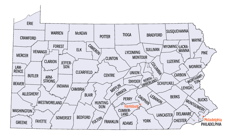
Pennsylvania Counties
There are sixty-seven counties of the Commonwealth of Pennsylvania in the United States of America. The city of Philadelphia is coterminous with Philadelphia County, and governmental functions have been consolidated since 1854.Monroe County, Pennsylvania
Monroe County Education, Geography, and History
Monroe County is a county in the state of Pennsylvania. Based on the 2010 census, the population was 169,842. Its county seat is
Stroudsburg. The county was formed from the northern section of Northampton County. Named in honor of James Monroe, the fifth president of the
United States, the county is located in the east of the state, along its border with New Jersey.
Monroe County comprises the East Stroudsburg, PA Metropolitan Statistical Area, which is also included in the New York-Newark, NY-NJ-CT-PA
Combined Statistical Area. It is located in the northeastern section of Pennsylvania.
Etymology - Origin of Monroe County Name
Named in honor of James Monroe, the fifth president of the United States
Demographics:
County QuickFacts: CensusBureau Quick Facts
Monroe County History
Created on April 1, 1836, from parts
of Northampton and Pike Counties and named for President James Monroe.
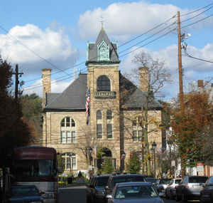
Stroudsburg, the county seat, was incorporated as a borough on February 6, 1815,
and named for Jacob Stroud, a settler.
Nicholas DuPui settled at Shawnee in 1729 and used the Old Mine Road to market
his wheat in New York. This area saw fighting in the French and Indian War; Fort
Penn was on the site that became Stroudsburg. The Brodhead family developed East
Stroudsburg. A road to Easton was opened in 1774. Monroe County was created
because Easton and Milford were too far away from too many people. After 1856
Monroe grew because it lay on the corridor used by railroads carrying
anthracite, although it has no coal of its own. The railroads started a big
tourist business for the Delaware Water Gap, and in the 1920s tourism spread
deep into the Poconos. Railroad transportation also made competitive Monroe's
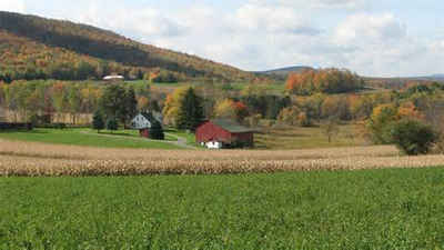
farm products, lumber, block ice, and mineral products. Monroe once manufactured
steam boilers, textiles, wooden products (barrels, clothespins, etc.), and
glass. The railroads declined in the 1930s. Today there is some printing,
publishing, trucking, and warehousing, as well as a retailing emphasis. Farms
occupy only 7 percent of the area and have not been major producers since the
decline of the dairy export market about 1900. The county had mushroomed since
the 1960s as a desirable residential area, and home construction is strong.
Geography: Land and Water
As reported by the Census Bureau, the county has a total area of 617 square miles (1,599 km2), of which, 608
square miles (1,576 km2) of it is land and 9 square miles (23 km2) of it (1.44%) is water. Monroe County was formed
from the northern section of Northampton County.
Neighboring Counties
Bordering counties are as follows:
- Wayne County (north)
- Pike County (northeast)
- Sussex County, New Jersey (northeast)
- Warren County, New Jersey (east)
- Northampton County (south)
- Carbon County (west)
- Luzerne County (northwest)
- Lackawanna County (northwest)
Education
Colleges and universities
East Stroudsburg University of Pennsylvania
Northampton Community College (Monroe Campus)
Public school districts
East Stroudsburg Area School District
Pleasant Valley School District
Pocono Mountain School District
Stroudsburg Area School District
Technology schools
Monroe Career & Technical Institute, Bartonsville, PA


Click Image to Enlarge
