

Click Image to Enlarge
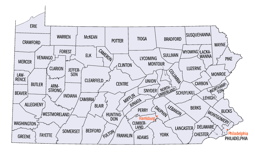
Pennsylvania Counties
There are sixty-seven counties of the Commonwealth of Pennsylvania in the United States of America. The city of Philadelphia is coterminous with Philadelphia County, and governmental functions have been consolidated since 1854.Perry County, Pennsylvania
Perry County Education, Geography, and History
Perry County is a county located in the state of Pennsylvania. Based on the 2010 census, the population was 45,969. The county seat is New
Bloomfield. The county was created on March 22, 1820, and was named after Oliver Hazard Perry, a hero of the War of 1812 who had recently
died. It was originally part of Cumberland County and was created in part because residents did not want to travel over the mountain to
Carlisle (the county seat of Cumberland County).
Perry County is included in the Harrisburg-Carlisle, PA Metropolitan Statistical Area.
Etymology - Origin of Perry County Name
Named in honor of Oliver Hazard Perry, victor in the Battle of Lake Erie.
Demographics:
County QuickFacts: CensusBureau Quick Facts
Perry County History
Created on March 22, 1820, from part
of Cumberland County and named in honor of Oliver Hazard Perry, victor in the
Battle of Lake Erie. Bloomfield, the county seat after 1827, bears the name
given to the tract of land in the original patent. It is said that it was laid
out in the month of June 1822, when clover was in bloom. It was incorporated as
a borough on March 14, 1831. The post office name for Bloomfield is New
Bloomfield.
The area was a favorite for illegal squatters before Indians yielded the land at
the Treaty of Albany in 1754. Sherman's Valley was the scene of Indian attacks
in 1755 and 1756. The county was formed in order to eliminate trips to Carlisle.
In 1820 Sherman's Valley boasted forty-eight grist and merchant mills, a forge,
ten fulling mills, sixty sawmills, eight carding machines, four oil mills, a
furnace, two tilted hammers, and a powder mill. Waterpower was king. The
Pennsylvania Canal had four locks in Perry; the economies of Duncannon, New
Buffalo, Liverpool, and Newport depended on the canal from 1828 to 1901, when it
was closed. Perry also had the Juniata Canal from 1828 to 1898. The county made
high-quality hickory barrel hoops. Lumbering continues today, serving over a
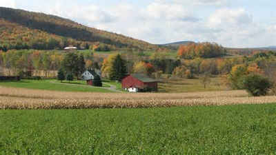
dozen active sawmills. Farms occupy 32 percent of the land. Retail sales have
been low in the last two decades due to convenient shopping center beyond the
county lines. Home building has been strong since 1970. Almost two-thirds of the
resident population work force is employed outside the county.
Geography: Land and Water
As reported by the Census Bureau, the county has a total area of 556 square miles (1,439 km2), of which, 554
square miles (1,434 km2) of it is land and 2 square miles (6 km2) of it (0.40%) is water.
Neighboring Counties
Bordering counties are as follows:
- Juniata County (north)
- Northumberland County (northeast)
- Dauphin County (east)
- Cumberland County (south)
- Franklin County (southwest)
Education
Public School Districts
Greenwood School District
While physically located in Perry County, the district also serves some residents of Juniata County.
Newport School District
Susquenita School District
While physically located in Perry County, the district also serves some residents of Dauphin County.
West Perry School District
Fannett-Metal School District


Click Image to Enlarge
